Difficulty
K4-K5
Extremely difficult via ferrata
Engelberg, OW
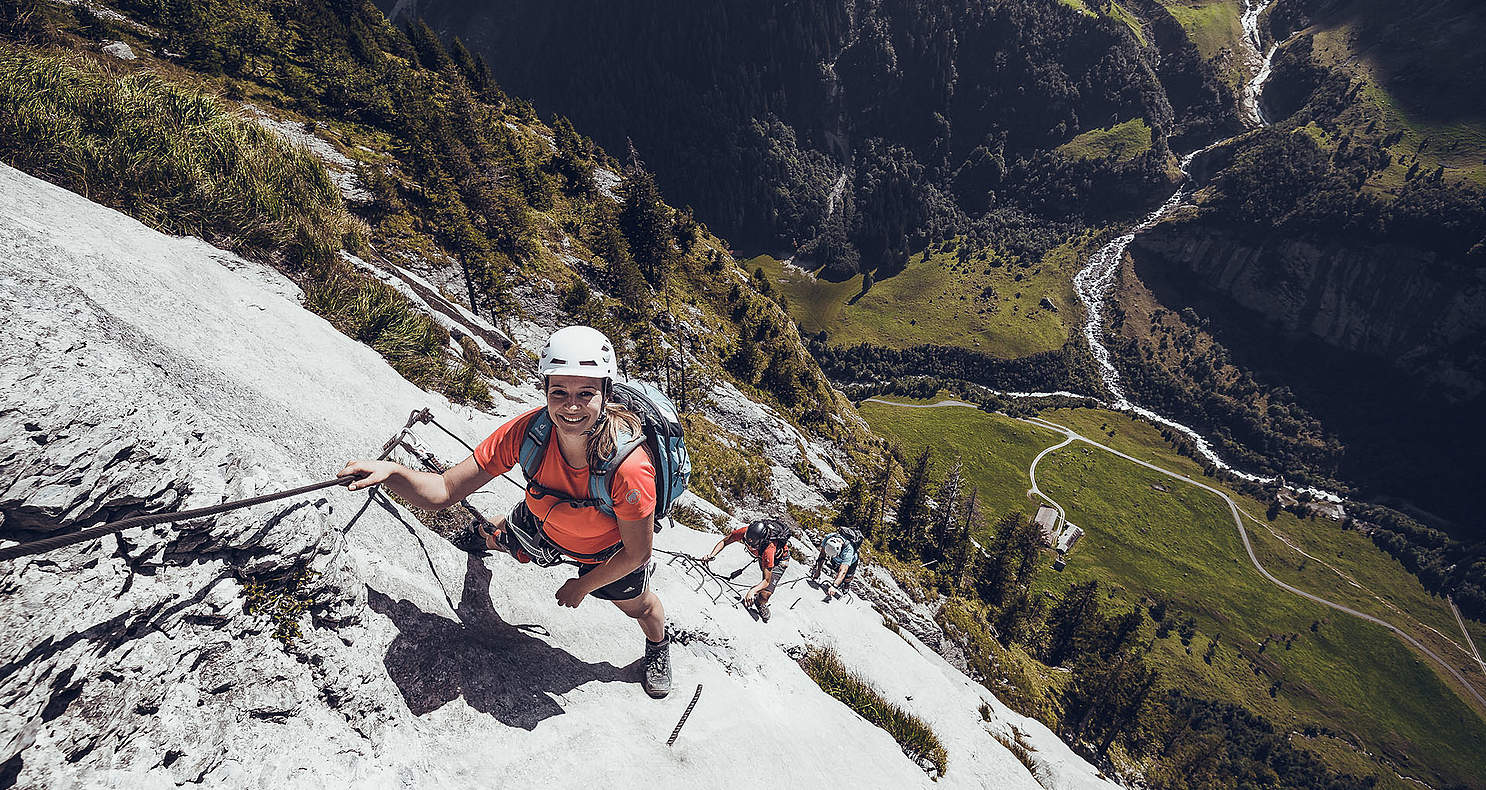
A steep and sustained Engelberg route on the Fürenwand, included in the seed set as a contrasting harder classic with official tourism coverage and…
Image: Source: Engelberg-Titlis Tourism
Difficulty
K4-K5
Extremely difficult via ferrata
Current status
Currently reported open
Checked 17 h ago
Total time
3 h
Approach + via ferrata + descent
Last lift down
Check Fürenalp cableway timetable
Segment timings and vertical stats from the current VFOS dataset.
Steel cables lead rightwards to a striking corner, then it becomes uncompromising: the only way is up! T-shaped iron bars facilitate the ascent, iron rungs continue towards a ladder. You'll barely touch the rock surface. Through varying degrees of exposure you climb, on and on. After some time you'll reach the lightly wooded terrace of the Jägerband, where a comfortable bench is waiting! Above the green terrace, the route leads back into steep terrain (after rainfall receive a free shower). On iron bars climb out into a vertical world. Words like 'deep' and 'bottomless' spring to mind here; you won't be the first to hesitate before stepping into the void. More iron rungs (like giant staples), interrupted by airy traverses, lead higher and higher over the compact limestone rock. Grandiose views open out onto the rocky backdrop of the innermost Engelberg valley. Then comes the final challenge: the almost 20 m high, mildly rickety rope ladder. The last climbing metres in comparison are a pleasant romp, and are followed by a nice trail through the meadows to Fürenalp (about 1840 m, 3 hours).
No escape point details are recorded yet.
Zoomable topographic map showing available approach, via ferrata, descent, start, finish, and parking geometry. The Download GPX link near the route map heading provides the same route geometry as a file.
Plan around the trailhead, parking, and public transport links.
Last lift down
Check operator
VFOS editorial ratings on a 1-5 scale.
Variety
How much the route changes in movement and terrain.
High 4/5
Complexity
Route-finding and technical problem-solving beyond pure grade.
High 4/5
Beauty
Scenery, setting, and overall aesthetic quality.
High 4/5
Exposure
Airiness and exposure independent of technical difficulty.
Very high 5/5
Sustained effort
How continuous or relentless the physical effort feels.
High 4/5
No crux tags are recorded yet.
A steep and sustained Engelberg route on the Fürenwand, included in the seed set as a contrasting harder classic with official tourism coverage and…
Check current local information before setting off.
In Switzerland, call Rega on 1414 for mountain rescue. European emergency number: 112.
Cell coverage can be patchy in gorges, valleys, and behind ridges. Download route notes and tell someone your plan.
This route is flagged as exposed or high-grade; avoid thunderstorms, wet cables, and fast-changing alpine weather.
https://www.engelberg.ch/en/summer/via-ferrata-climbing/
Last scraped: 28 Jun 2026 · Facts harvested from public source pages; VFOS stores extracted facts and links back to source.
https://ferrataguide.com/ferrata/F%C3%BCrenwand_Klettersteig
Last scraped: 28 Jun 2026 · Facts harvested from public source pages; VFOS stores extracted facts and links back to source.
https://www.openstreetmap.org/way/450366924
Last scraped: 30 May 2026 · OpenStreetMap object reference used for seed coordinate provenance; data available under ODbL.
https://www.sac-cas.ch/en/huts-and-tours/sac-route-portal/furenalp-8122/via-ferrata/furenwand-via-ferrata-1692/
Last scraped: 28 Jun 2026 · Facts harvested from public source pages; VFOS stores extracted facts and links back to source.
Weather