Difficulty
K4
Very difficult via ferrata
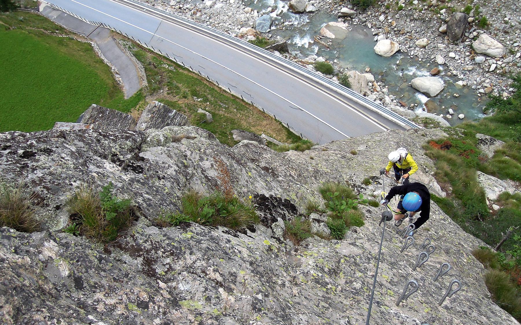
Gabi (Simplon), VS
Image: Eugen E. und Hildegard Hüsler
Difficulty
K4
Very difficult via ferrata
Current status
Today falls within the published opening season
Checked 14 h ago
Total time
2 h 35 min
Approach + via ferrata + descent
This K4 via ferrata climbs a 250-metre, east-facing wall directly above the Gabi road tunnel near Simplon, just south of the pass. Builders installed over 700 iron rungs and bars, making the climbing safe though strenuous on the arms, especially near the top. An optional three-cable bridge crossing adds a playful start for those seeking extra challenge.
Zoomable topographic map showing available approach, via ferrata, descent, start, finish, and parking geometry. The Download GPX link near the route map heading provides the same route geometry as a file.
Segment timings and vertical stats from the current VFOS dataset.
From the Gabi, Simplon bus stop, walk 260 metres down the road to the tunnel entrance, then follow a signposted path branching off to descend toward the Doveria riverbed, where the via ferrata begins.
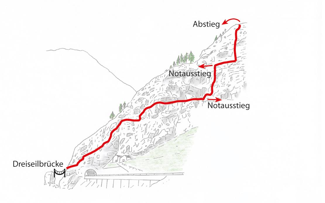
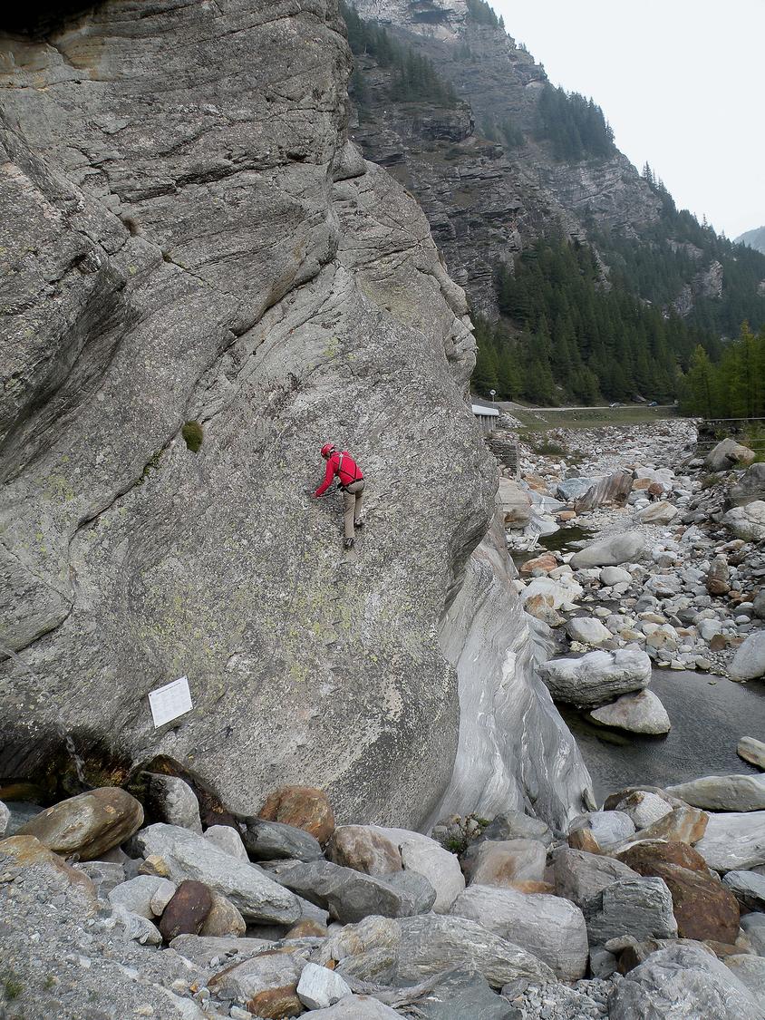
Start either at the foot of the wall or by crossing the optional three-cable bridge to the right. Climb tiered rock with easy moves to reach a clear ledge on the lower face, then follow it rightward until cables resume upward. Artificial rungs assist over the next 50 metres of steep terrain to another ledge; traverse right to face the final near-vertical wall. Ascend this section step by step past a Swiss flag, finishing via rocky slabs to the via ferrata's exit.
From the exit, a faint trail leads left to a hairpin on the Bleikuwald road (1427 m). Follow the road briefly downhill, then take the marked hiking path on the left descending through open larch woods back to Gabi.
No escape point details are recorded yet.
Typical published season
The monthly window follows the owner-reviewed source guidance; live conditions can override it.
VFOS editorial ratings on a 1-5 scale.
Variety
How much the route changes in movement and terrain.
- -
Complexity
Route-finding and technical problem-solving beyond pure grade.
- -
Beauty
Scenery, setting, and overall aesthetic quality.
- -
Exposure
Airiness and exposure independent of technical difficulty.
- -
Sustained effort
How continuous or relentless the physical effort feels.
- -
No crux tags are recorded yet.
Source ratings on the SAC-CAS 1-4 scale.
Plan around the trailhead, parking, and public transport links.
Last lift down
Check operator
Check current local information before setting off.
In Switzerland, call Rega on 1414 for mountain rescue. European emergency number: 112.
Cell coverage can be patchy in gorges, valleys, and behind ridges. Download route notes and tell someone your plan.
This route is flagged as exposed or high-grade; avoid thunderstorms, wet cables, and fast-changing alpine weather.
https://www.brig-simplon.ch/tour/klettersteig-gabi
Last scraped: 2 Aug 2026 · Opening-season source retained for status provenance.
https://www.sac-cas.ch/de/huetten-und-touren/sac-tourenportal/bleikuwald-7798/berg-und-alpinwandern/zustieg-klettersteig-gabi-simplon-986/
Last scraped: 2 Aug 2026 · Official SAC-CAS Route Portal source; English API data and attribution retained.
https://www.sac-cas.ch/de/huetten-und-touren/sac-tourenportal/bleikuwald-7798/berg-und-alpinwandern/abstieg-klettersteig-gabi-simplon-987/
Last scraped: 2 Aug 2026 · Official SAC-CAS Route Portal source; English API data and attribution retained.
https://www.sac-cas.ch/de/huetten-und-touren/sac-tourenportal/bleikuwald-7798/klettersteig/klettersteig-gabi-simplon-726/
Last scraped: 2 Aug 2026 · Official SAC-CAS Route Portal source; English API data and attribution retained.
No contested fields are currently flagged.
Weather