Difficulty
K3-K4
Very difficult via ferrata
Berner Alpen
Klettersteig Gantrisch is a K3-K4 via ferrata in Berner Alpen.
Image: Source: website
Difficulty
K3-K4
Very difficult via ferrata
Current status
No reliable current status yet
Checked 17 h ago
Total time
3 h 45 min
Approach + via ferrata + descent
Last lift down
Check Berner Alpen timetable
Segment timings and vertical stats from the current VFOS dataset.
Also possible to approach from the south, via Leiterenpass, but this is much longer (ca. 3hrs)
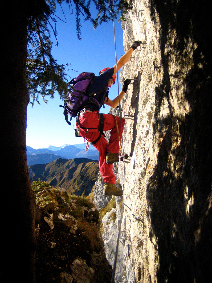
From the get-go it becomes immediately apparent that this ferrata is no 'walk in the park'. Overhanging rock leans out above you, and the tough start leads straight into the almost vertical, 70 metre high "Kürewändli". This is followed by comparatively easy traversing on grassy ledges interspersed with rock steps and aluminium ladders. Further left, you must ascend the final challenge: the slightly overhanging, airy «Horberkante». Steel cables continue to the top; the summit of Gantrisch (2176 m, 2½ hrs.) where a great panorama awaits.
Various routes possible. The upper parts are steep and exposed. Move with caution. The variant over the Morgetenpass is a little longer, but less demanding and can include a detour to the Gantrischseeli.
No escape point details are recorded yet.
Zoomable topographic map showing available approach, via ferrata, descent, start, finish, and parking geometry. The Download GPX link near the route map heading provides the same route geometry as a file.
Plan around the trailhead, parking, and public transport links.
Last lift down
Check operator
VFOS editorial ratings on a 1-5 scale.
Variety
How much the route changes in movement and terrain.
TBC TBC
Complexity
Route-finding and technical problem-solving beyond pure grade.
TBC TBC
Beauty
Scenery, setting, and overall aesthetic quality.
TBC TBC
Exposure
Airiness and exposure independent of technical difficulty.
TBC TBC
Sustained effort
How continuous or relentless the physical effort feels.
TBC TBC
No crux tags are recorded yet.
Klettersteig Gantrisch is a K3-K4 via ferrata in Berner Alpen.
Check current local information before setting off.
In Switzerland, call Rega on 1414 for mountain rescue. European emergency number: 112.
Cell coverage can be patchy in gorges, valleys, and behind ridges. Download route notes and tell someone your plan.
This route is flagged as exposed or high-grade; avoid thunderstorms, wet cables, and fast-changing alpine weather.
https://www.gantrisch.ch/entdecken/aktivitaeten/zu-fuss/klettern/
Last scraped: 4 Jun 2026 · Source used for attribution and factual cross-checking; canonical VFOS text is paraphrased separately.
https://ferrataguide.com/ferrata/Gantrisch_Klettersteig
Last scraped: 4 Jun 2026 · Source used for attribution and factual cross-checking; canonical VFOS text is paraphrased separately.
https://www.openstreetmap.org/relation/2427982
Last scraped: 4 Jun 2026 · OpenStreetMap object reference used for coordinate/source provenance; data available under ODbL.
https://www.sac-cas.ch/en/huts-and-tours/sac-route-portal/gantrisch-746/via-ferrata/gantrisch-via-ferrata-294/
Last scraped: 5 Jun 2026 · SAC-CAS route portal source used for route geometry and factual cross-checking; VFOS links back for attribution.
https://www.openstreetmap.org/way/182235084
Last scraped: 4 Jun 2026 · OpenStreetMap object reference used for coordinate/source provenance; data available under ODbL.
No contested fields are currently flagged.
Weather