Difficulty
K4
Very difficult via ferrata
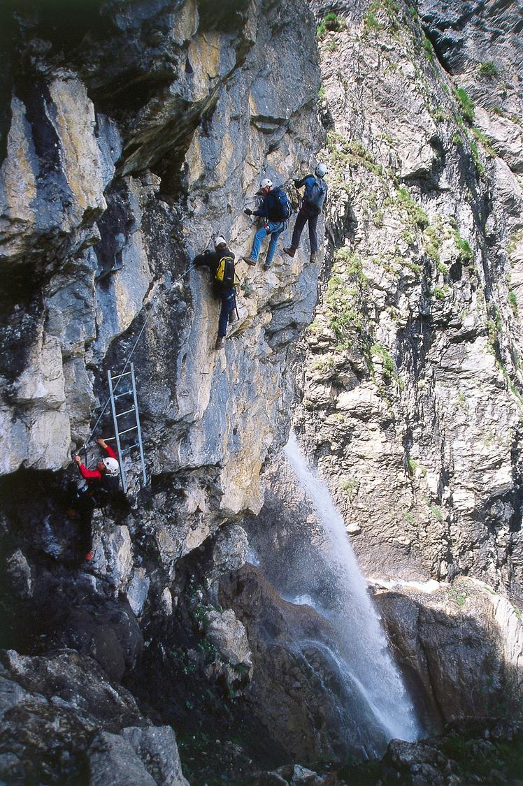
Kandersteg, train station, BE
Image: Daniel Anker
Difficulty
K4
Very difficult via ferrata
Current status
The latest source indicates this route is open
Checked 14 h ago
Total time
3 h 30 min
Approach + via ferrata + descent
A striking K4 via ferrata climbing a 350-metre wall of pillars and gullies above Kandersteg, near the Lötschberg tunnel's northern portal. Built in 2005, it's one of Switzerland's most popular ferratas, combining sustained exposed climbing with two Nepali-style suspension bridges over the Allmibach stream and an optional zip line. The route demands strong arms due to a scarcity of artificial rungs, relying instead on the cable for progress.
Zoomable topographic map showing available approach, via ferrata, descent, start, finish, and parking geometry. The Download GPX link near the route map heading provides the same route geometry as a file.
Segment timings and vertical stats from the current VFOS dataset.
From Kandersteg railway station, follow the hiking trail alongside the tracks, then pass beneath them and turn right at the Allmibach-Kander confluence. Continue north of the stream before bearing southwest to reach the via ferrata start at about 1250 m, level with the lowest waterfall. The start can also be reached from the Allmenalp cableway's valley station in about 25 minutes.
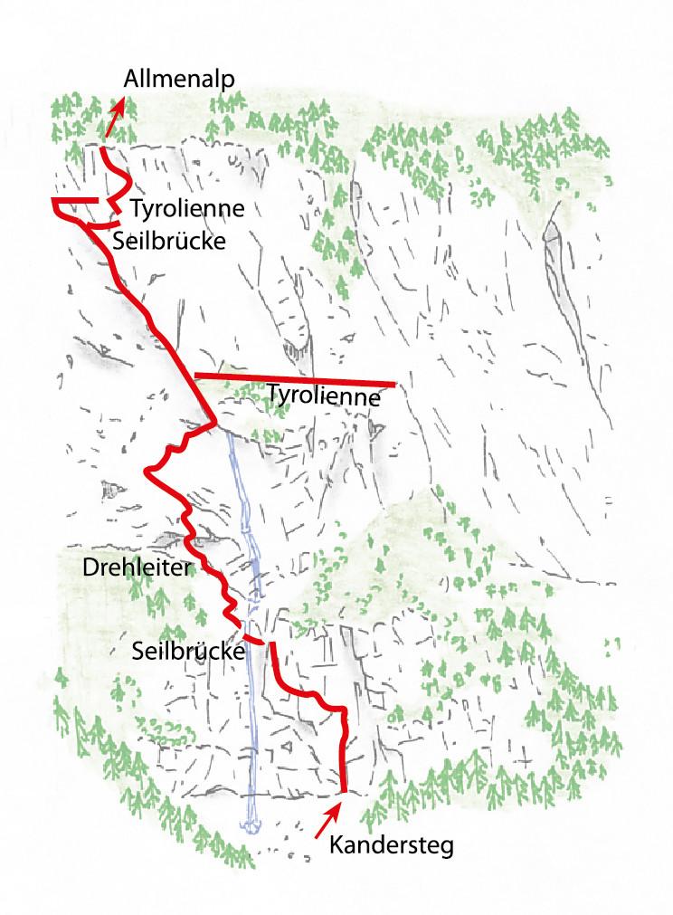
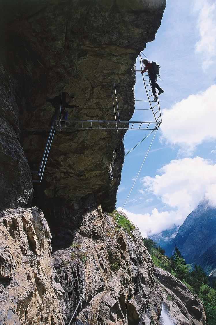
Climb the initial 100-metre wall keeping left, followed by a long traverse reminiscent of the Eiger's Hinterstoisser traverse. Cross the Allmibach on a three-rope Nepali bridge, then ascend a grassy slope to a flag and route book beneath a 10-metre overhanging roof, overcome via a ladder twisted 180 degrees. Climb left of the waterfall to a ridge above the stream, then tackle the crux: a long, strenuous rightward traverse around a corner aided by ladders. Cross the Allmibach again on a second rope bridge (or take the 40-metre zip line with pulley and brake rope), with the last climber controlling descent by hand on the support rope. Finish via a partly vertical face to exit around 1600 m, then hike 20 minutes to Undere Allme (1723 m) at the cableway's top station.
From the via ferrata's exit, climb about 25 minutes to the Allmenalp cableway's top station and restaurant at Undere Allme (1723 m). From there, either ride the cable car down to the valley and walk to the railway station, or descend on foot via Ryharts and Schneitböde in around 1¼ hours.
No escape point details are recorded yet.
Typical published season
31 October represents 'approximately the end of October'; weather can shorten the season.
VFOS editorial ratings on a 1-5 scale.
Variety
How much the route changes in movement and terrain.
- -
Complexity
Route-finding and technical problem-solving beyond pure grade.
- -
Beauty
Scenery, setting, and overall aesthetic quality.
- -
Exposure
Airiness and exposure independent of technical difficulty.
- -
Sustained effort
How continuous or relentless the physical effort feels.
- -
No crux tags are recorded yet.
Source ratings on the SAC-CAS 1-4 scale.
Plan around the trailhead, parking, and public transport links.
Last lift down
Check operator
Check current local information before setting off.
In Switzerland, call Rega on 1414 for mountain rescue. European emergency number: 112.
Cell coverage can be patchy in gorges, valleys, and behind ridges. Download route notes and tell someone your plan.
This route is flagged as exposed or high-grade; avoid thunderstorms, wet cables, and fast-changing alpine weather.
https://www.allmenalp.ch/en/experience/climbing.html
Last scraped: 2 Aug 2026 · Opening-season source retained for status provenance.
https://www.sac-cas.ch/de/huetten-und-touren/sac-tourenportal/allmenalp-8207/berg-und-alpinwandern/zustieg-klettersteig-kandersteg-allmenalp-1842/
Last scraped: 2 Aug 2026 · Official SAC-CAS Route Portal source; English API data and attribution retained.
https://www.sac-cas.ch/de/huetten-und-touren/sac-tourenportal/allmenalp-8207/berg-und-alpinwandern/abstieg-klettersteig-kandersteg-allmenalp-1841/
Last scraped: 2 Aug 2026 · Official SAC-CAS Route Portal source; English API data and attribution retained.
https://www.sac-cas.ch/de/huetten-und-touren/sac-tourenportal/allmenalp-8207/klettersteig/klettersteig-kandersteg-allmenalp-1840/
Last scraped: 2 Aug 2026 · Official SAC-CAS Route Portal source; English API data and attribution retained.
No contested fields are currently flagged.
Weather