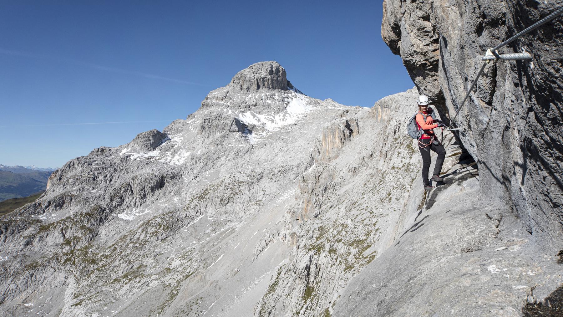
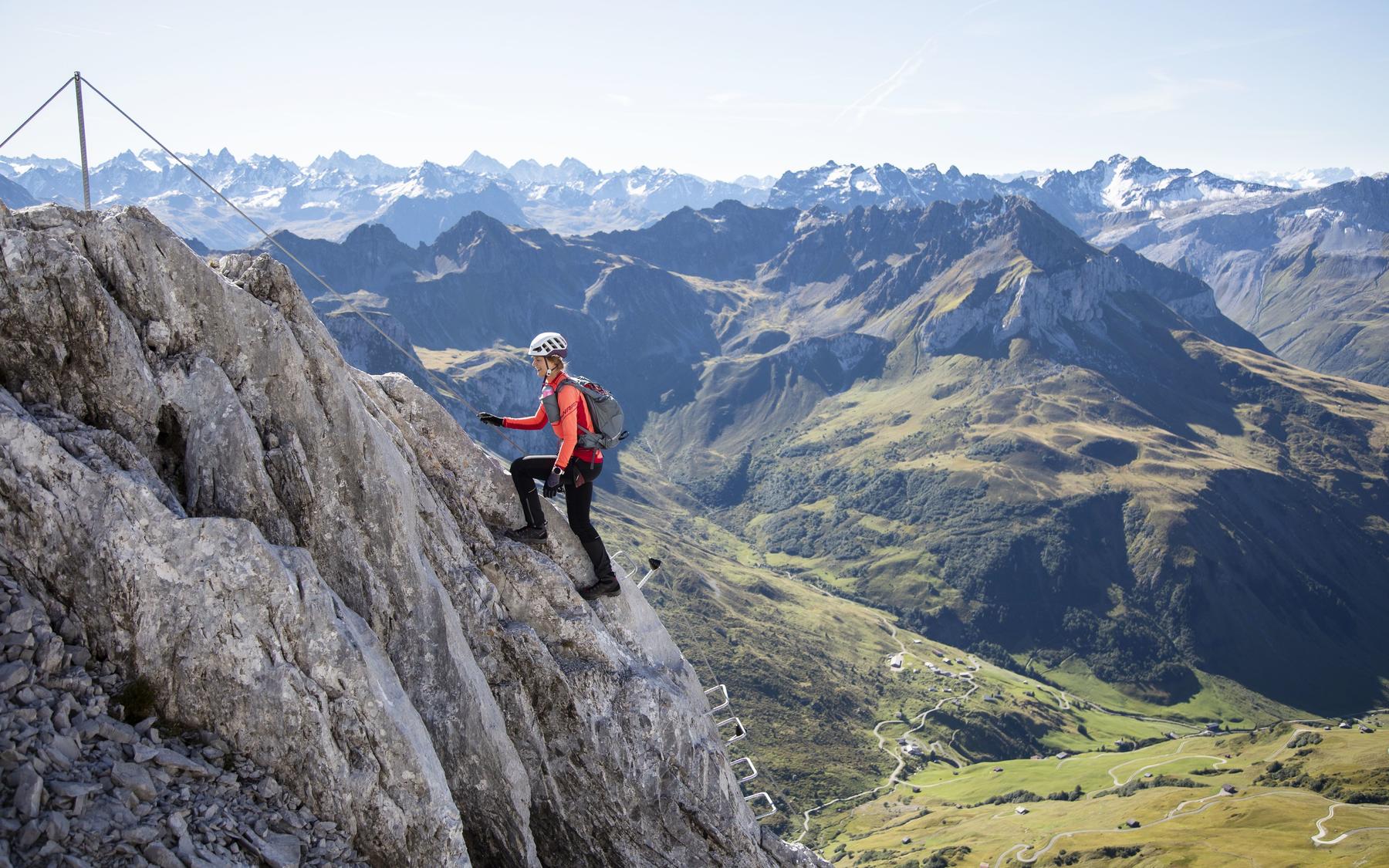
Aussichtsreich: Klettersteig Partnunblick.
K4-K5 Car-free possible

St. Antönien, GR

Klettersteig Partnunblick

The Partnunblick via ferrata offers a demanding K4-5 outing above St.

Image: Riccardo Götz / Prättigau Tourismus

Difficulty

K4-K5

Extremely difficult via ferrata
Current status

Confirmed open

The latest source indicates this route is open

Checked 1 h ago

Total time

6 h 35 min

Approach + via ferrata + descent

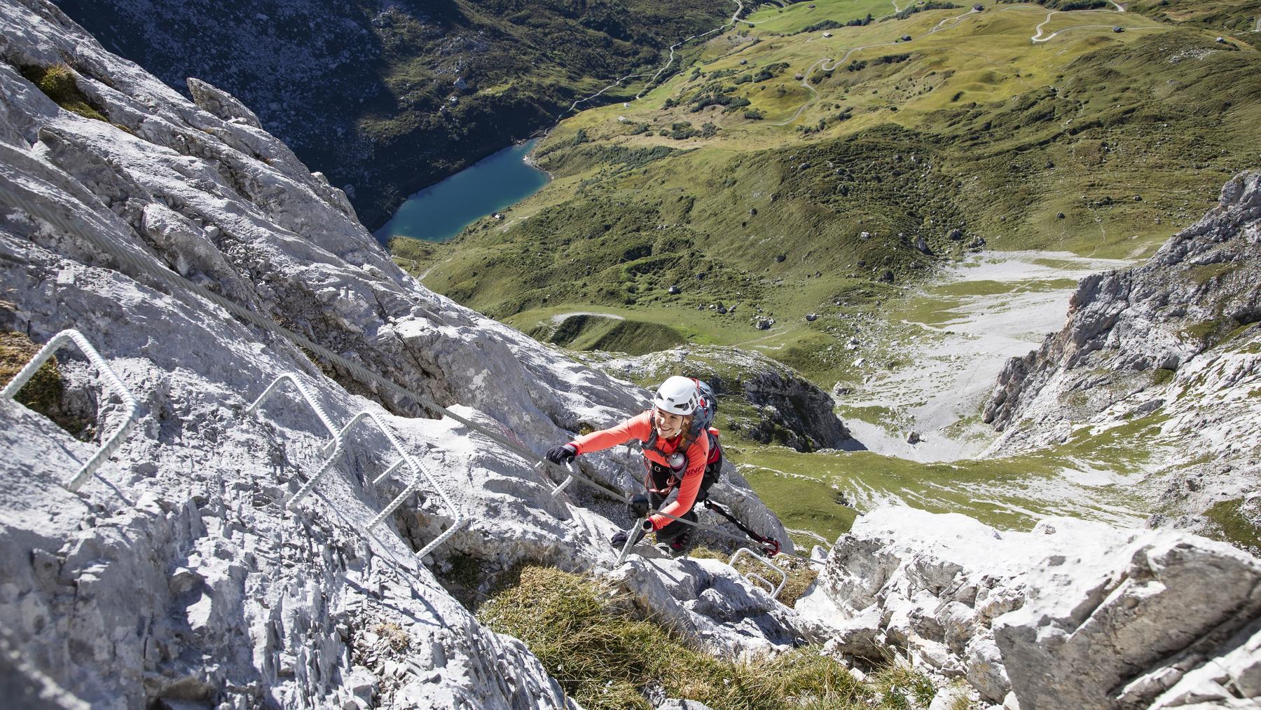
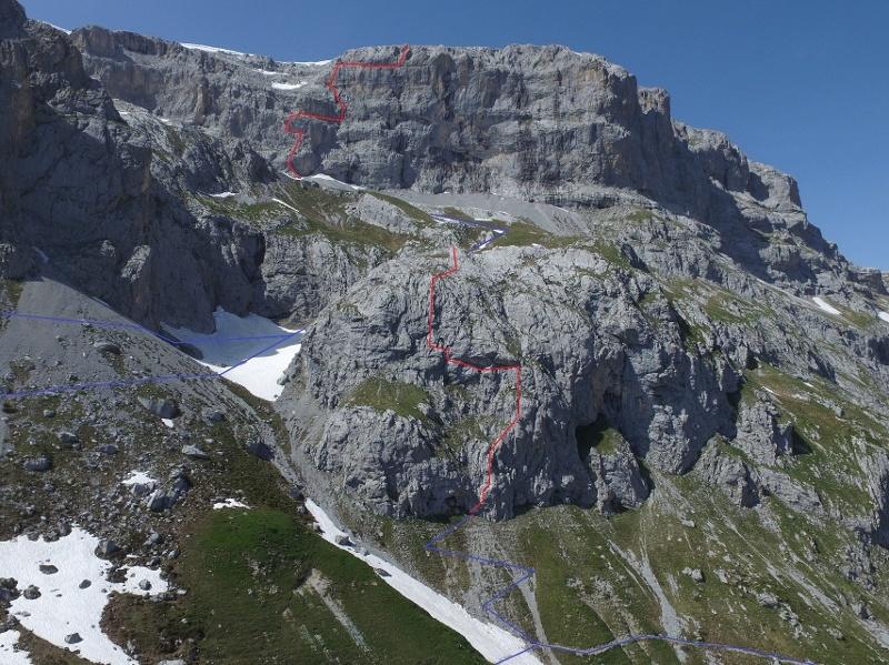
Route description The Partnunblick via ferrata offers a demanding K4-5 outing above St. Antönien, starting just above the easier family via ferrata of the same name. It tackles vertical and occasionally slightly overhanging rock, with constant views to the Schijenflue and Sulzfluh peaks. Climbers are treated to a striking bird's-eye view down onto the turquoise Partnunsee. The route finishes near the Austrian border, where a mountain trail continues directly to the summit of the Sulzfluh, making it a great complement to the classic Sulzfluh via ferrata.

The Partnunblick via ferrata offers a demanding K4-5 outing above St. Antönien, starting just above the easier family via ferrata of the same name. It tackles vertical and occasionally slightly overhanging rock, with constant views to the Schijenflue and Sulzfluh peaks. Climbers are treated to a striking bird's-eye view down onto the turquoise Partnunsee. The route finishes near the Austrian border, where a mountain trail continues directly to the summit of the Sulzfluh, making it a great complement to the classic Sulzfluh via ferrata.

Route map

Download GPX

Zoomable topographic map showing available approach, via ferrata, descent, start, finish, and parking geometry. The Download GPX link near the route map heading provides the same route geometry as a file.

Annotated route info/map available from praettigau.info.
Start
46.98863, 9.84870
Finish
46.98861, 9.84876
Parking Parkplatz P6, St. Antönien
46.98863, 9.84870

Approach / VF / Descent

Segment timings and vertical stats from the current VFOS dataset.

Total: 6 h 35 min

Approach

Access
Duration
1 h 45 min
Distance
4.2 km
Ascent
736 m
Descent
-
Elevation
1,620 m-2,356 m

Segment boundary derived from the source track, published entry elevation, and route description.

Via ferrata

K4-K5
Duration
2 h 50 min
Distance
890 m
Ascent
345 m
Descent
-
Elevation
2,608 m-2,701 m

Segment boundary derived from the source track, published entry elevation, and route description.

Descent

Exit
Duration
2 h
Distance
5.9 km
Ascent
-
Descent
1,081 m
Elevation
1,620 m-2,701 m

Segment boundary derived from the source track, published entry elevation, and route description.

Total duration
6 h 35 min
Total distance
5.1 km
Total ascent
1,081 m
Total descent
-

Escape points

No escape point details are recorded yet.

Opening season

Typical published season

Source
Jan
Feb
Mar
Apr
May
Jun
Jul
Aug
Sep
Oct
Nov
Dec

Live status source; no fixed annual season was published.

Transport

Plan around the trailhead, parking, and public transport links.

Last lift down

Check operator

Parking

Parkplatz P6, St. Antönien

Paid parking at P6 below Partnunstafel.

Coordinates
46.98863, 9.84870

Bus

PostBus and Bus alpin

Rail to Schiers or Küblis, PostBus to St. Antönien, then reservation-only Bus alpin.

Coordinates
-

Route feel

VFOS editorial ratings on a 1-5 scale.

Ratings -

Variety

How much the route changes in movement and terrain.

- -

Complexity

Route-finding and technical problem-solving beyond pure grade.

- -

Beauty

Scenery, setting, and overall aesthetic quality.

- -

Exposure

Airiness and exposure independent of technical difficulty.

- -

Sustained effort

How continuous or relentless the physical effort feels.

- -

Crux tags

No crux tags are recorded yet.

Photos

6 source photos
Aussichtsreich: Klettersteig Partnunblick.
Aussichtsreich: Klettersteig Partnunblick.© Riccardo Götz / Prättigau Tourismus
Im grossen Quergang "Himmelswäg" Klettersteig Partnunblick.
Im grossen Quergang "Himmelswäg" Klettersteig Partnunblick.© Riccardo Götz / Prättigau Tourismus
Im Klettersteig Partnunblick, unten der Partnunsee
Im Klettersteig Partnunblick, unten der Partnunsee© Riccardo Götz / Prättigau Tourismus
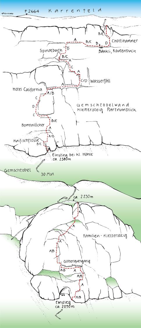
Klettertopo Klettersteige Partnunblick.
Klettertopo Klettersteige Partnunblick.© Vital Eggenberger / Prättigau Tourismus
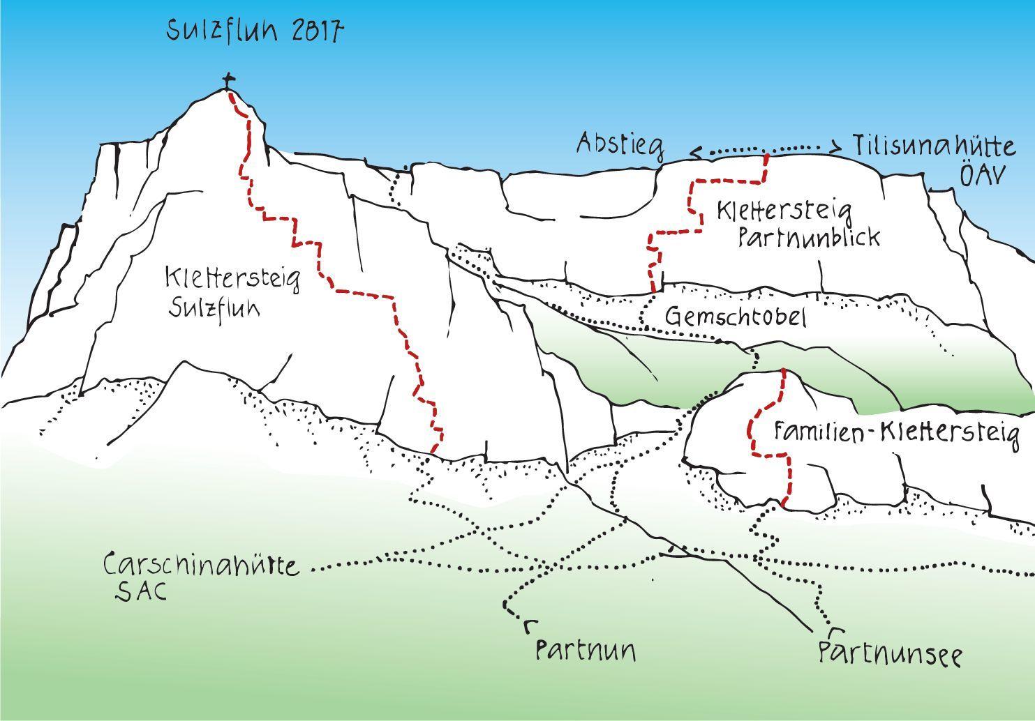
Übersicht Klettersteige St. Antönien
Übersicht Klettersteige St. Antönien© Vital Eggenberger / Prättigau Tourismus
Übersicht Klettersteige Partnunblick.
Übersicht Klettersteige Partnunblick.© Andres Scherrer / Prättigau Tourismus

Safety notes

Check current local information before setting off.

Rega 1414

Emergency

In Switzerland, call Rega on 1414 for mountain rescue. European emergency number: 112.

Mobile signal

Cell coverage can be patchy in gorges, valleys, and behind ridges. Download route notes and tell someone your plan.

Storms

This route is flagged as exposed or high-grade; avoid thunderstorms, wet cables, and fast-changing alpine weather.

Sources & data Attribution, source priority, and field-review status for this route.

Referenced sources

  • Opening season · Prättigau Tourismus

    https://www.praettigau.info/de/aktivitaeten/sommer/klettern/klettersteige

    Official

    Last scraped: 2 Aug 2026 · Opening-season source retained for status provenance.

  • Prättigau Marketing

    https://www.praettigau.info/de/touren/klettersteig-partnunblick-st-antoenien

    Official

    Last scraped: 2 Aug 2026 · Owner-approved replacement source retained with harvested facts and attribution.

Field review

No contested fields are currently flagged.

At a glance

Location
St. Antönien, GR
Elevation range
2,702 m
Car-free possible
Yes

Weather

Trailhead forecast