Difficulty
K3
Difficult via ferrata
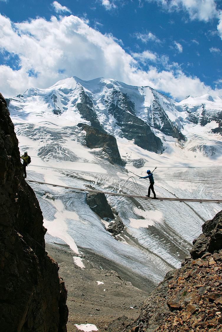
Diavolezza, summit station, GR
Image: Daniel Anker
Difficulty
K3
Difficult via ferrata
Current status
The latest source indicates this route is open
Checked 14 h ago
Total time
3 h
Approach + via ferrata + descent
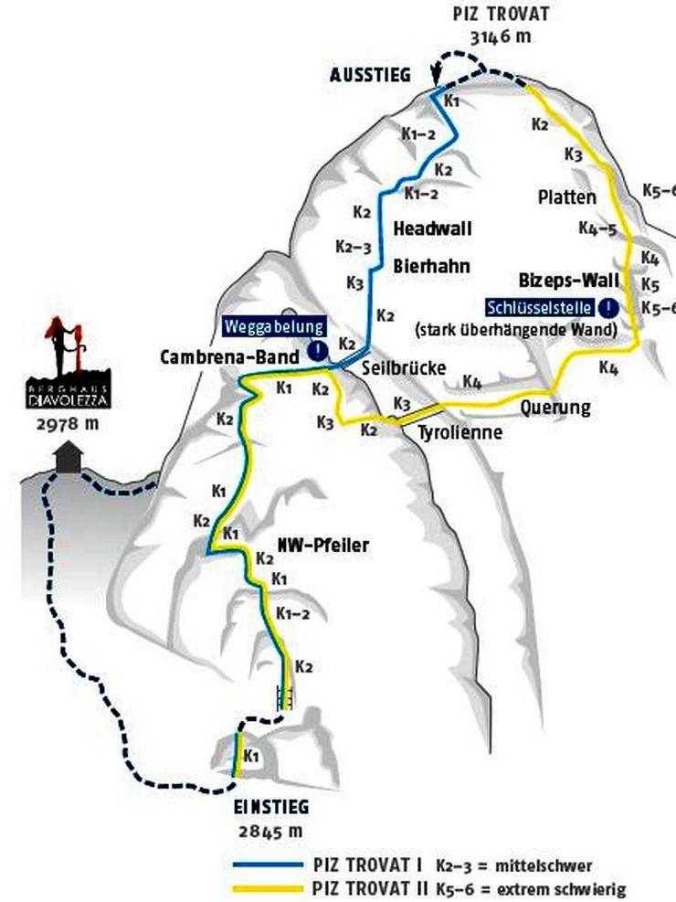
The Piz Trovat via ferrata climbs the solid west flank of this lesser-known 3146 m summit above the Diavolezza, offering constant views over the famous Palü-Bellavista-Bernina panorama. The standard line (Trovat I) is graded K2 with sections of K3, while climbers can extend onto the far more demanding Trovat II variant (K5-6), which includes long overhanging passages, a Tyrolienne crossing and the notorious "Bizeps Wall". Total touring time is roughly 2½-3 hours including approach and descent.
Zoomable topographic map showing available approach, via ferrata, descent, start, finish, and parking geometry. The Download GPX link near the route map heading provides the same route geometry as a file.
Segment timings and vertical stats from the current VFOS dataset.
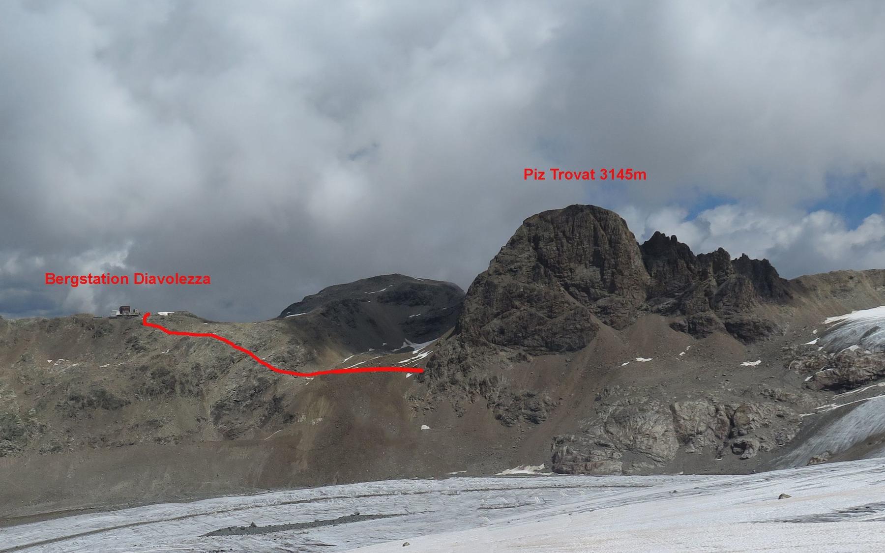
From the terrace of Berghaus Diavolezza (2973 m), follow the blue-signed, white-blue-white marked path across broken rock, rubble and scree down into the basin beneath Piz Trovat. A short final rise brings you to the via ferrata's entrance and information board at about 2880 m, roughly half an hour from the start.
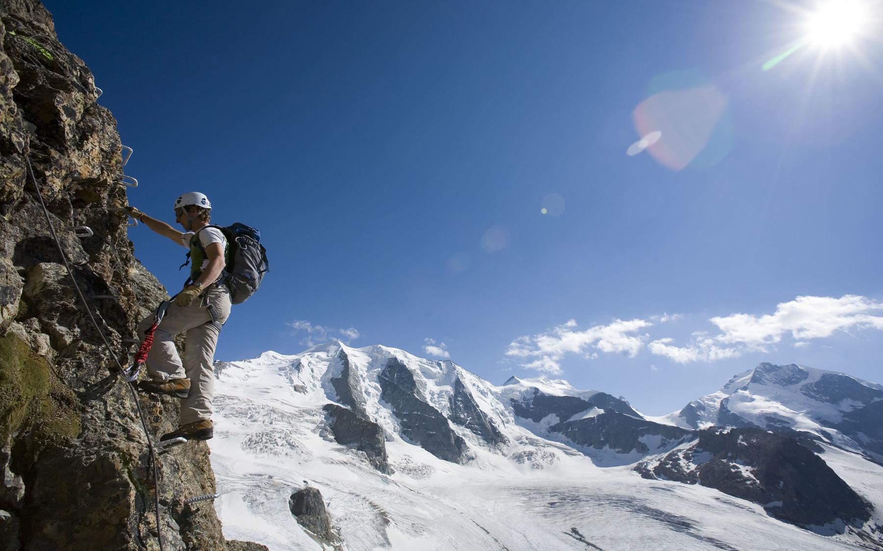
The route begins steeply before easing into broken terrain, followed by a vertical ladder. Iron rungs lead up, first directly and then rightward along a ledge with continuous views over the Upper Engadine peaks. Where a rock band offers the branch-off to the harder Trovat II option, the main route descends briefly to a suspension bridge spanning a deep couloir. The crux headwall follows: a near-vertical pitch fully equipped with metal rungs and holds, demanding but well protected. Further sustained climbing on iron rungs with minimal rock contact leads to easier ground, finishing just left of the summit on Piz Trovat's scree-covered top. Climbers seeking more challenge can instead follow Trovat II, descending over slabs to a Tyrolienne crossing, a long traverse, and the very steep, strenuous "Bizeps Wall" before rejoining easier terrain to the summit.
Follow the white-blue-white markings down the steep eastern gravel flank of Piz Trovat, then traverse left across an unnamed saddle (3006 m) before returning to the Diavolezza.
No escape point details are recorded yet.
Typical published season
The SAC inventory groups the Piz Trovat route; no fixed annual season was published.
VFOS editorial ratings on a 1-5 scale.
Variety
How much the route changes in movement and terrain.
- -
Complexity
Route-finding and technical problem-solving beyond pure grade.
- -
Beauty
Scenery, setting, and overall aesthetic quality.
- -
Exposure
Airiness and exposure independent of technical difficulty.
- -
Sustained effort
How continuous or relentless the physical effort feels.
- -
No crux tags are recorded yet.
Source ratings on the SAC-CAS 1-4 scale.
Plan around the trailhead, parking, and public transport links.
Last lift down
Check operator
Check current local information before setting off.
In Switzerland, call Rega on 1414 for mountain rescue. European emergency number: 112.
Cell coverage can be patchy in gorges, valleys, and behind ridges. Download route notes and tell someone your plan.
Avoid thunderstorms and wet rock. Via ferrata cables can become hazardous quickly in poor weather.
https://www.corvatsch-diavolezza.ch/it/attuale/impianti-e-piste
Last scraped: 2 Aug 2026 · Opening-season source retained for status provenance.
https://www.sac-cas.ch/de/huetten-und-touren/sac-tourenportal/piz-trovat-2035/berg-und-alpinwandern/zustieg-klettersteig-piz-trovat-870/
Last scraped: 2 Aug 2026 · Official SAC-CAS Route Portal source; English API data and attribution retained.
https://www.sac-cas.ch/de/huetten-und-touren/sac-tourenportal/piz-trovat-2035/berg-und-alpinwandern/abstieg-klettersteig-piz-trovat-871/
Last scraped: 2 Aug 2026 · Official SAC-CAS Route Portal source; English API data and attribution retained.
https://www.sac-cas.ch/de/huetten-und-touren/sac-tourenportal/piz-trovat-2035/klettersteig/klettersteig-piz-trovat-678/
Last scraped: 2 Aug 2026 · Official SAC-CAS Route Portal source; English API data and attribution retained.
No contested fields are currently flagged.
Weather