Difficulty
K4
Very difficult via ferrata
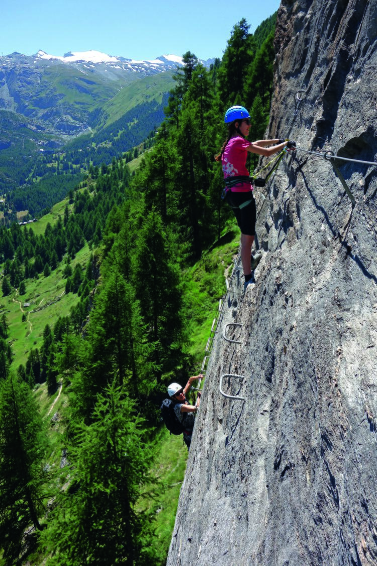
Zermatt, VS
Image: Anker Daniel
Difficulty
K4
Very difficult via ferrata
Current status
The latest source indicates this route is open
Checked 14 h ago
Total time
50 min
Approach + via ferrata + descent
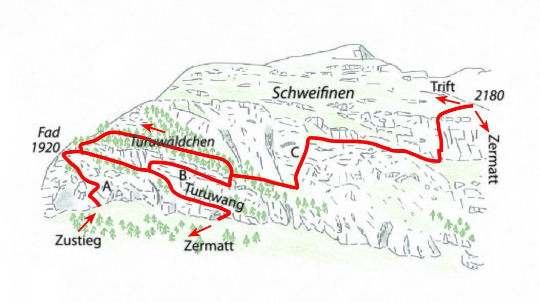
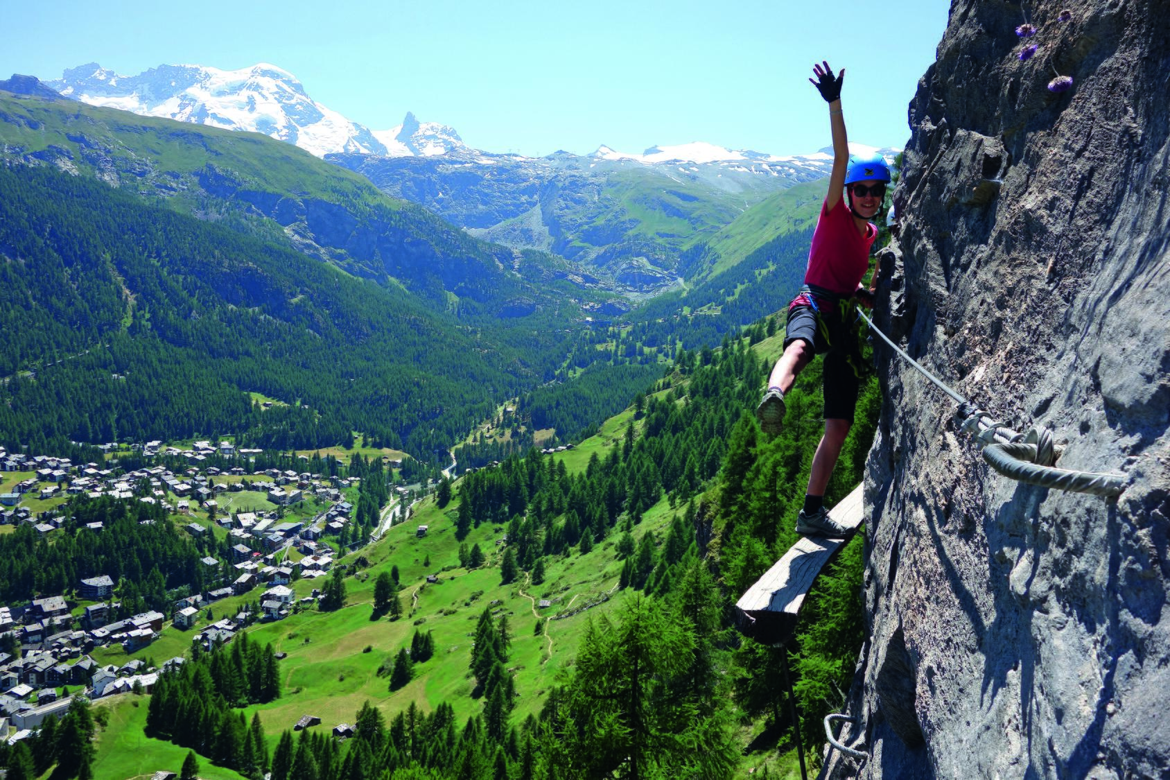
Route B is the demanding middle section of the Zermatt-Schweifinen via ferrata network, climbing steep, partly overhanging rock walls above the village. Rated K4+, it offers airy positions and fine views over Zermatt's rooftops before joining the meadows of Schweifinen. The route can be combined with the easier Route A or the longer Route C.
Zoomable topographic map showing available approach, via ferrata, descent, start, finish, and parking geometry. The Download GPX link near the route map heading provides the same route geometry as a file.
Segment timings and vertical stats from the current VFOS dataset.
From Zermatt train station, follow Bahnhofstrasse, turning right past the Alpinezentrum toward Trift. Climb the path past Hotel Omnia, cross the plateau at Bodmen, and head toward the Triftschlucht. Before the bridge over the Triftbach, turn sharply right to reach the via ferrata start at about 1800 m, roughly 30 minutes from the station.
From the junction, Route B ascends an old steep stone staircase before tackling a smooth, vertical, and partly overhanging wall, finishing with a metal wire ladder that forms the technical crux. The route then descends through mostly vertical terrain with a highly exposed traverse across slightly unstable wooden rungs. It finishes by climbing out of the Turuwang wall into the Turu forest, where Routes B and C diverge near 1890 m.
From the top of the ferrata, follow the marked footpath back down to Zermatt train station.
No escape point details are recorded yet.
Typical published season
Route-specific URL discovery remains pending.
VFOS editorial ratings on a 1-5 scale.
Variety
How much the route changes in movement and terrain.
- -
Complexity
Route-finding and technical problem-solving beyond pure grade.
- -
Beauty
Scenery, setting, and overall aesthetic quality.
- -
Exposure
Airiness and exposure independent of technical difficulty.
- -
Sustained effort
How continuous or relentless the physical effort feels.
- -
No crux tags are recorded yet.
Source ratings on the SAC-CAS 1-4 scale.
Plan around the trailhead, parking, and public transport links.
Last lift down
Check operator
Check current local information before setting off.
In Switzerland, call Rega on 1414 for mountain rescue. European emergency number: 112.
Cell coverage can be patchy in gorges, valleys, and behind ridges. Download route notes and tell someone your plan.
This route is flagged as exposed or high-grade; avoid thunderstorms, wet cables, and fast-changing alpine weather.
https://zermatt.swiss/p/klettersteig-schweifinen-route-a-01tVj000005EwcTIAS
Last scraped: 2 Aug 2026 · Opening-season source retained for status provenance.
https://www.sac-cas.ch/de/huetten-und-touren/sac-tourenportal/schweifinen-7800/berg-und-alpinwandern/zustieg-klettersteig-zermatt-schweifinen-1821/
Last scraped: 2 Aug 2026 · Official SAC-CAS Route Portal source; English API data and attribution retained.
https://www.sac-cas.ch/de/huetten-und-touren/sac-tourenportal/schweifinen-7800/berg-und-alpinwandern/abstieg-klettersteig-zermatt-schweifinen-route-a-b-1825/
Last scraped: 2 Aug 2026 · Official SAC-CAS Route Portal source; English API data and attribution retained.
https://www.sac-cas.ch/de/huetten-und-touren/sac-tourenportal/schweifinen-7800/klettersteig/klettersteig-zermatt-schweifinen-route-b-730/
Last scraped: 2 Aug 2026 · Official SAC-CAS Route Portal source; English API data and attribution retained.
No contested fields are currently flagged.
Weather