Difficulty
K3-K4
Very difficult via ferrata
Freiburger-Alpen
Moléson Klettersteig - Ferrata de la Face is a K3-K4 via ferrata in Freiburger-Alpen.
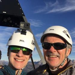
Image: Source: ferrataguide:369
Difficulty
K3-K4
Very difficult via ferrata
Current status
Currently reported open
Checked 17 h ago
Total time
2 h 40 min
Approach + via ferrata + descent
Last lift down
Check Freiburger-Alpen timetable
Segment timings and vertical stats from the current VFOS dataset.
Head up over grassy rock steps to the start of the vertical north wall (sign). A long traverse with some small descent leads right to the first vertical, briefly overhanging wall; retreat possible until here. Anyone who manages the first wall, will also manage the rest of this ferrata. In the middle part of the face, the route skirts the characteristic 'floating meadow'. On the second vertical section, and traverse section holds the route book. Then come the two finishing options. 1) the right variation, "Le surplomb", heads out over the overhang; difficulty BLACK / TD / KS5+. 2) the left variation, par "L'esquive", is a little easier; difficulty Red / D / KS4+. The left route splits again: easiest is to go right, where you will join the top of the "Le surplomb" variant (15 m), otherwise, for medium difficulty head straight up, over a last, slightly overhanging 'sting in the tail' (25 m).
No escape point details are recorded yet.
Zoomable topographic map showing available approach, via ferrata, descent, start, finish, and parking geometry. The Download GPX link near the route map heading provides the same route geometry as a file.
Plan around the trailhead, parking, and public transport links.
Last lift down
Check operator
VFOS editorial ratings on a 1-5 scale.
Variety
How much the route changes in movement and terrain.
TBC TBC
Complexity
Route-finding and technical problem-solving beyond pure grade.
TBC TBC
Beauty
Scenery, setting, and overall aesthetic quality.
TBC TBC
Exposure
Airiness and exposure independent of technical difficulty.
TBC TBC
Sustained effort
How continuous or relentless the physical effort feels.
TBC TBC
No crux tags are recorded yet.
Moléson Klettersteig - Ferrata de la Face is a K3-K4 via ferrata in Freiburger-Alpen.
Check current local information before setting off.
In Switzerland, call Rega on 1414 for mountain rescue. European emergency number: 112.
Cell coverage can be patchy in gorges, valleys, and behind ridges. Download route notes and tell someone your plan.
This route is flagged as exposed or high-grade; avoid thunderstorms, wet cables, and fast-changing alpine weather.
https://ferrataguide.com/ferrata/Mol%C3%A9son_Klettersteig_-_Ferrata_de_la_Face
Last scraped: 4 Jun 2026 · Source used for attribution and factual cross-checking; canonical VFOS text is paraphrased separately.
https://www.sac-cas.ch/en/huts-and-tours/sac-route-portal/le-moleson-7794/via-ferrata/via-ferrata-le-moleson-la-face-722/
Last scraped: 5 Jun 2026 · SAC-CAS route portal source used for route geometry and factual cross-checking; VFOS links back for attribution.
No contested fields are currently flagged.
Weather