Difficulty
K4
Very difficult via ferrata
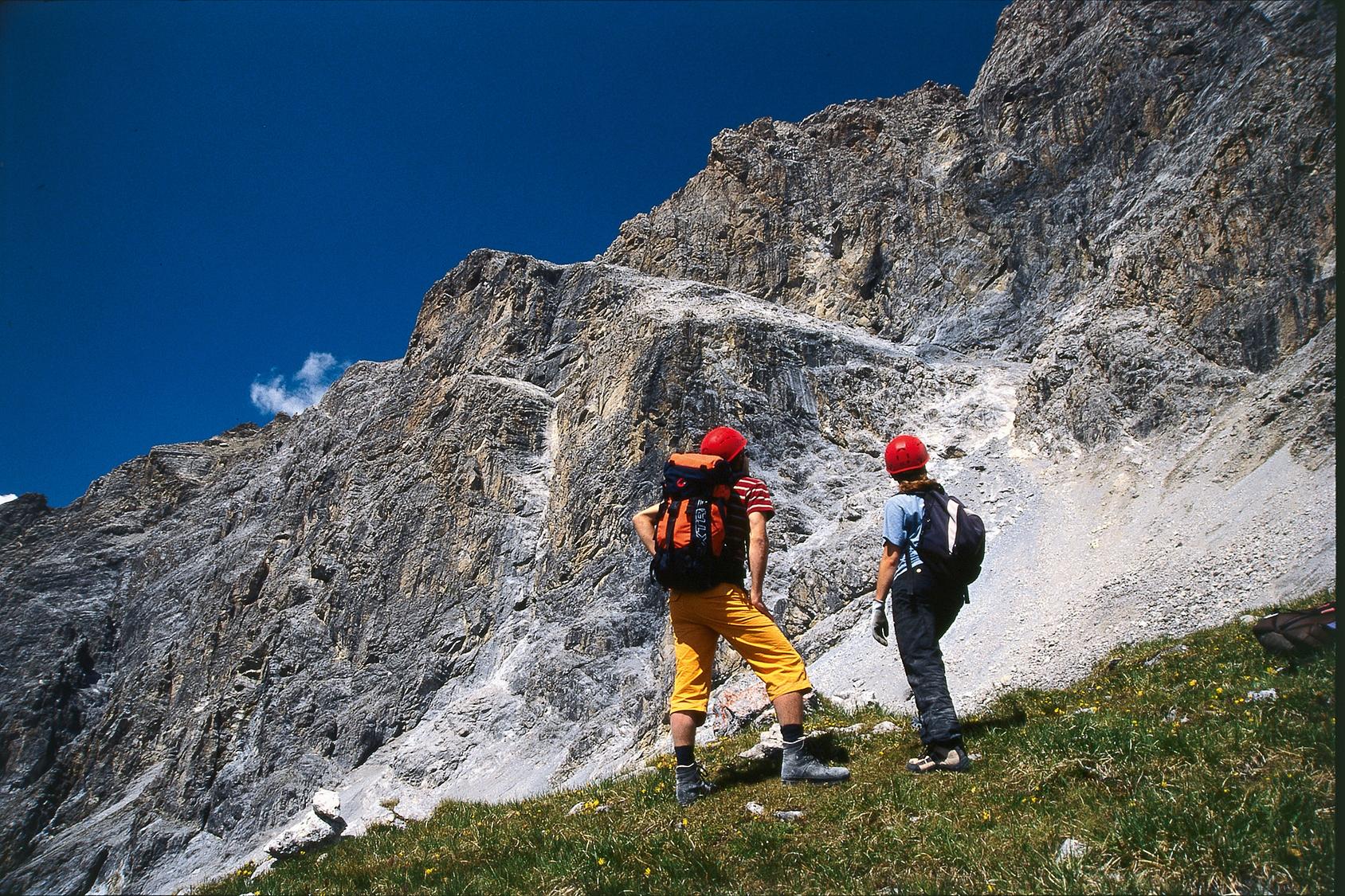
Savognin, posta, GR
Image: Daniel Anker
Difficulty
K4
Very difficult via ferrata
Current status
The latest source indicates this route is closed
Checked 14 h ago
Total time
5 h 30 min
Approach + via ferrata + descent
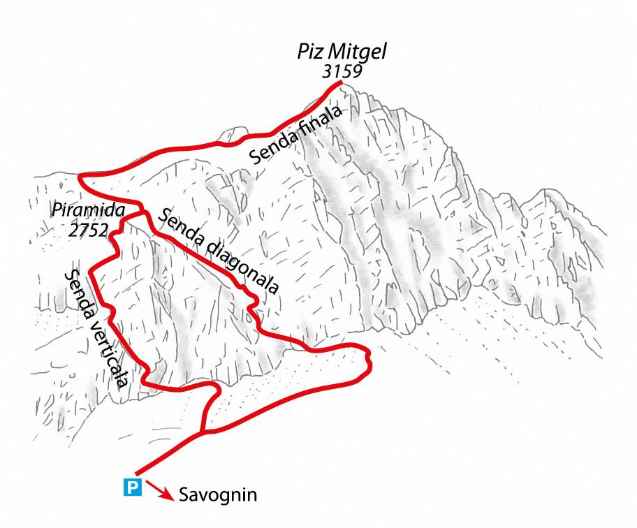
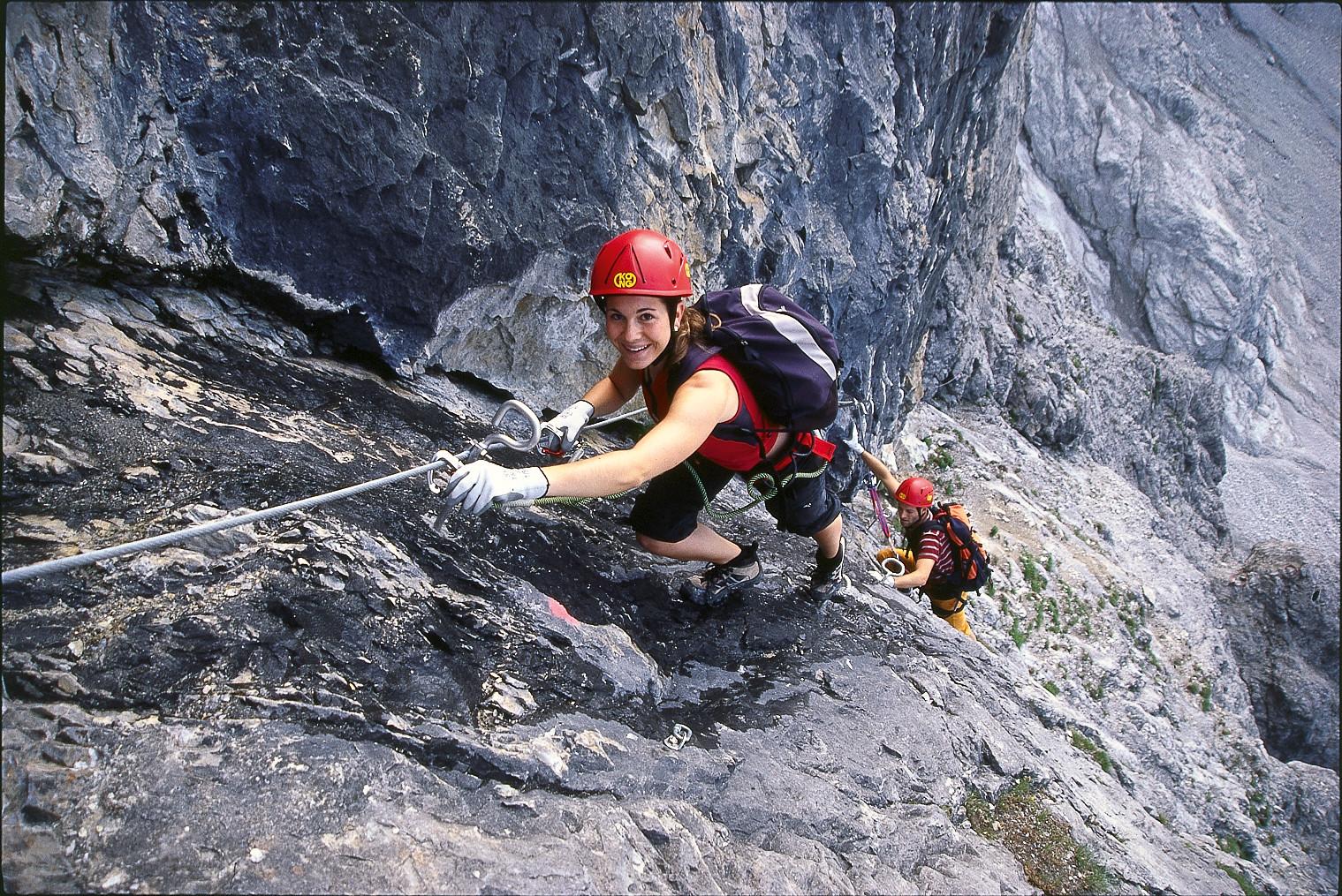
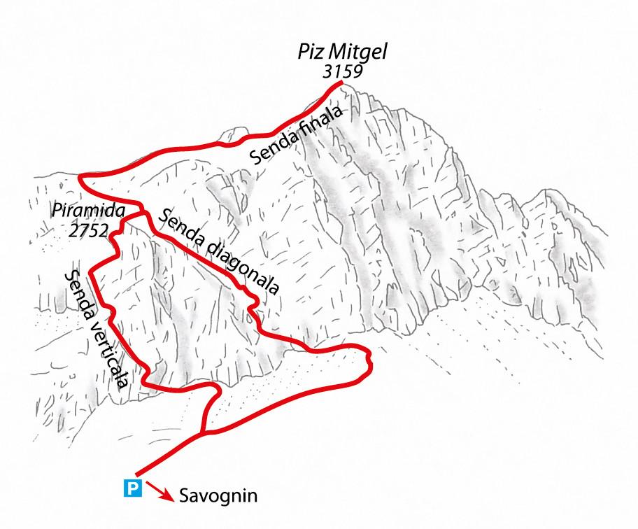
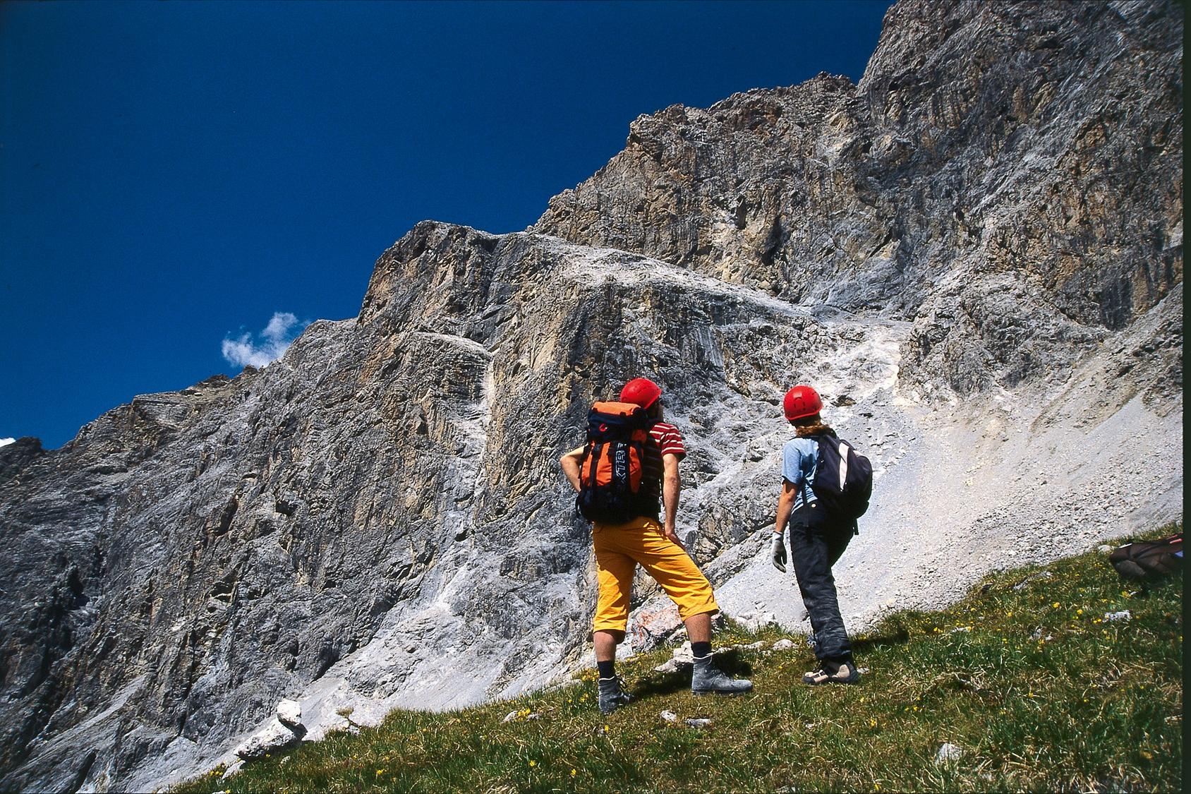
The steeper of the two Senda ferrada lines on the south-west face of Piz Mitgel, northernmost of the Bergüner Stöcke above Savognin. Built in 2005 by hotelier Nicola Foglia and mountain guide Geni Ballat, it takes a direct, well-engineered line up the wall, gaining around 350 m in roughly an hour and three quarters of climbing. It tops out at the Piramida rather than on the summit. From there SAC gives two options: continue on the Senda finala to the top of Piz Mitgel, or descend the Senda diagonala. The long walk-in from Savognin is shared with the Senda diagonala und finala and splits at a marked junction below the face.
Zoomable topographic map showing available approach, via ferrata, descent, start, finish, and parking geometry. The Download GPX link near the route map heading provides the same route geometry as a file.
Segment timings and vertical stats from the current VFOS dataset.
From Savognin, hike about 680 m of ascent (2 hours) to Nassegl, or drive/bike a paved then gravel road 6 km to the Plang la Curvanera car park (1844 m) north of Alp Nassegl. From the car park, follow the closed alp road toward Nassegl, turning off before reaching the alp. A white-blue-white marked trail then climbs to the junction where the Senda verticala and Senda diagonala split; go right for the diagonala or left for the verticala.
From the junction, the Senda verticala climbs left through a distinctive diagonal corner into the 'Amfiteater'. A long traverse beneath the yellow-hued Pare melna wall leads to overhanging cracks demanding real upper-body strength. A further short diagonal ledge gains the top, and a few final steps reach the Piramida (2752 m), about 3.5 hours from the start. From here, continue via the Senda finala to the summit or descend the Senda diagonala.
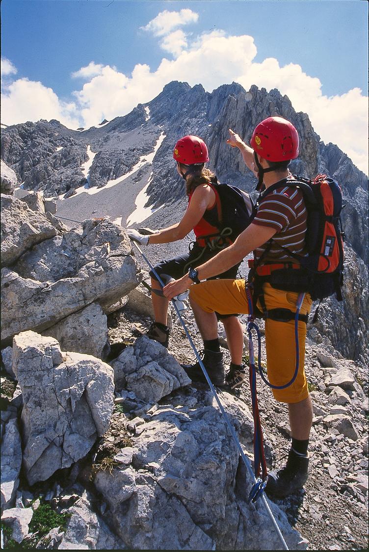
Descend via the Senda diagonala: from the fork, go right to an oblique rock band running across the southwest face, following scree and slabs into a couloir where the old normal route once ran; the cabled section begins near 2550 m and climbs northwest beneath the cliff band to exit around 2740 m at the Piramida. For the summit route instead, from the Piramida head northeast across a scree basin to the West Ridge, then climb scree flanks and traverse southwest below the summit rocks to approach from the south. The final Senda finala follows cables on the west side of the north ridge before curving round to reach the summit of Piz Mitgel (3159 m) from the south.
No escape point details are recorded yet.
Typical published season
Authoritative closure notice; no reopening date is published.
VFOS editorial ratings on a 1-5 scale.
Variety
How much the route changes in movement and terrain.
- -
Complexity
Route-finding and technical problem-solving beyond pure grade.
- -
Beauty
Scenery, setting, and overall aesthetic quality.
- -
Exposure
Airiness and exposure independent of technical difficulty.
- -
Sustained effort
How continuous or relentless the physical effort feels.
- -
No crux tags are recorded yet.
Source ratings on the SAC-CAS 1-4 scale.
Plan around the trailhead, parking, and public transport links.
Last lift down
Check operator
Check current local information before setting off.
In Switzerland, call Rega on 1414 for mountain rescue. European emergency number: 112.
Cell coverage can be patchy in gorges, valleys, and behind ridges. Download route notes and tell someone your plan.
This route is flagged as exposed or high-grade; avoid thunderstorms, wet cables, and fast-changing alpine weather.
https://www.sac-cas.ch/de/die-alpen/klettersteig-piz-mitgel-geschlossen-2781/
Last scraped: 2 Aug 2026 · Opening-season source retained for status provenance.
https://www.sac-cas.ch/de/huetten-und-touren/sac-tourenportal/piz-mitgel-1172/berg-und-alpinwandern/zustieg-senda-ferrada-piz-mitgel-875/
Last scraped: 2 Aug 2026 · Official SAC-CAS Route Portal source; English API data and attribution retained.
https://www.sac-cas.ch/de/huetten-und-touren/sac-tourenportal/piz-mitgel-1172/klettersteig/senda-ferrada-piz-mitgel-senda-diagonala-und-finala-711/
Last scraped: 2 Aug 2026 · Official SAC-CAS Route Portal source; English API data and attribution retained.
https://www.sac-cas.ch/de/huetten-und-touren/sac-tourenportal/piz-mitgel-1172/klettersteig/senda-ferrada-piz-mitgel-senda-verticala-710/
Last scraped: 2 Aug 2026 · Official SAC-CAS Route Portal source; English API data and attribution retained.
No contested fields are currently flagged.
Weather