Difficulty
K4-K5
Extremely difficult via ferrata
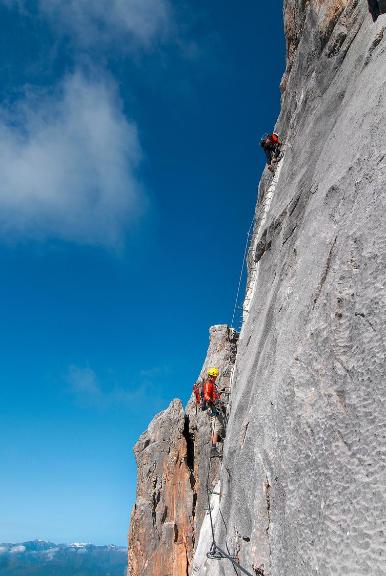
St. Antönien, Litzirüti, GR
Image: Manfred Kostner
Difficulty
K4-K5
Extremely difficult via ferrata
Current status
Today falls within the published opening season
Checked 14 h ago
Total time
14 h 30 min
Approach + via ferrata + descent
The Sulzfluh via ferrata is a long, demanding route on steep, high-quality Rätikon limestone, combining strenuous vertical sections with very exposed traverses. Rated K4 with sections of K4-5, it suits fit, experienced mountaineers rather than beginners. A linked route to the Gauablick cave on the Montafon side extends the outing further, best split over two days with a hut stay at Carschina or Tilisuna.
Zoomable topographic map showing available approach, via ferrata, descent, start, finish, and parking geometry. The Download GPX link near the route map heading provides the same route geometry as a file.
Segment timings and vertical stats from the current VFOS dataset.
From St. Antönien Rüti, follow the road or a shortcut trail up to Partnun, then cross the bridge over the Partnunbach where a blue sign marks the via ferrata start. Continue up through meadows, staying right at the fork toward Carschina, then head steeply upward near P. 2124 to reach the ferrata's base at 2360 m.
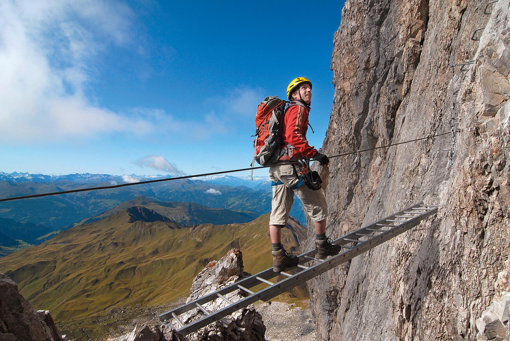
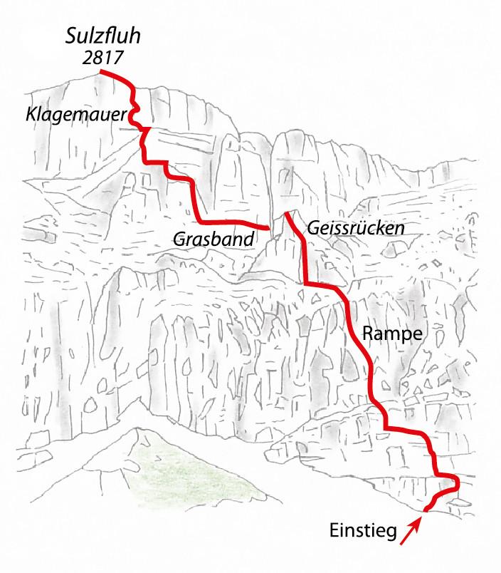
The route climbs cabled slabs to a vertical ladder and iron-runged chimney, then eases across the 'Obelixquergang' before a steep, rung-assisted rock step. Further ledges lead to the natural-holds 'ramp' and a grassy band, followed by a stiff 15-meter wall behind the 'Geissrücken' rest bench. Difficulty builds through a long traverse, a powerful 30-meter wall, the scenic 'Panoramica' slab, and a technical traverse, before the three-cable 'Deichmannsteg' bridge. The final crux is the overhanging, 40-meter 'Wailing Wall,' after which easier ground leads to the summit cross at 2817 m.
From the summit, head west along a broad ridge, then bear right onto the north flank down to a saddle. Turn right again to descend east through the Gemschotobel, arcing west past a small cliff band before P. 2251, and rejoin the approach path back to St. Antönien Rüti.
No escape point details are recorded yet.
Typical published season
The monthly window follows the owner-reviewed source guidance; live conditions can override it.
VFOS editorial ratings on a 1-5 scale.
Variety
How much the route changes in movement and terrain.
- -
Complexity
Route-finding and technical problem-solving beyond pure grade.
- -
Beauty
Scenery, setting, and overall aesthetic quality.
- -
Exposure
Airiness and exposure independent of technical difficulty.
- -
Sustained effort
How continuous or relentless the physical effort feels.
- -
No crux tags are recorded yet.
Source ratings on the SAC-CAS 1-4 scale.
Plan around the trailhead, parking, and public transport links.
Last lift down
Check operator
During the summer months it is possible to drive up to parking No. 6, in winter to No. 5 and to P No. 12 in the direction of Gafia. For more information regarding parking private vehicles: https://www.luzein.ch/de/verwaltung/parkplaetze and https://www.luzein.ch/system/files/2020-09/Infoblatt Parkplätze Internet 2020.pdf
During the summer months it is possible to drive up to parking No. 6, in winter to No. 5 and to P No. 12 in the direction of Gafia. For more information regarding parking private vehicles: https://www.luzein.ch/de/verwaltung/parkplaetze and https://www.luzein.ch/system/files/2020-09/Infoblatt Parkplätze Internet 2020.pdf
Check current local information before setting off.
In Switzerland, call Rega on 1414 for mountain rescue. European emergency number: 112.
Cell coverage can be patchy in gorges, valleys, and behind ridges. Download route notes and tell someone your plan.
This route is flagged as exposed or high-grade; avoid thunderstorms, wet cables, and fast-changing alpine weather.
https://www.praettigau.info/de/aktivitaeten/sommer/klettern/klettersteige
Last scraped: 2 Aug 2026 · Opening-season source retained for status provenance.
https://www.praettigau.info/de/touren/klettersteig-sulzfluh-st-antoenien
Last scraped: 4 Aug 2026 · Owner-approved opening-status source from the 2026-08-04 review.
https://www.sac-cas.ch/de/huetten-und-touren/sac-tourenportal/sulzfluh-1911/berg-und-alpinwandern/zustieg-sulzfluh-klettersteig-857/
Last scraped: 2 Aug 2026 · Official SAC-CAS Route Portal source; English API data and attribution retained.
https://www.sac-cas.ch/de/huetten-und-touren/sac-tourenportal/sulzfluh-1911/berg-und-alpinwandern/sulzfluh-abstieg-nach-st-antoenien-rueti-859/
Last scraped: 2 Aug 2026 · Official SAC-CAS Route Portal source; English API data and attribution retained.
https://www.sac-cas.ch/de/huetten-und-touren/sac-tourenportal/sulzfluh-1911/klettersteig/sulzfluhklettersteig-675/
Last scraped: 2 Aug 2026 · Official SAC-CAS Route Portal source; English API data and attribution retained.
No contested fields are currently flagged.
Weather