Difficulty
K5
Extremely difficult via ferrata
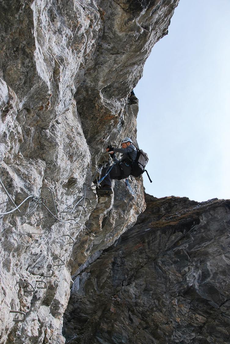
Grimentz, Torrent, VS
Image: Daniel Anker
Difficulty
K5
Extremely difficult via ferrata
Current status
No reliable current status yet
Checked 14 h ago
Total time
2 h
Approach + via ferrata + descent
This sporty, "à la française" via ferrata climbs the shaded flank above Lac de Moiry, opposite the dam's 148 m arch, starting and ending near the Grimentz bus stop. Built in 2005 in an industrial setting below an army bunker, it graduates from red-rated lower sections to increasingly steep black passages higher up. A 60 m steel-and-plank suspension bridge, added in 2009, spans an exposed gap and links to an easier escape route or the harder continuation. Open June to mid/late October, with grades ranging K2+ to K5+ depending on the section chosen.
Zoomable topographic map showing available approach, via ferrata, descent, start, finish, and parking geometry. The Download GPX link near the route map heading provides the same route geometry as a file.
Segment timings and vertical stats from the current VFOS dataset.
From the Grimentz Torrent bus stop, check the information board, then follow the road in a wide arc up and around to the base of the cliff on the east side before leaving the road for the rock.
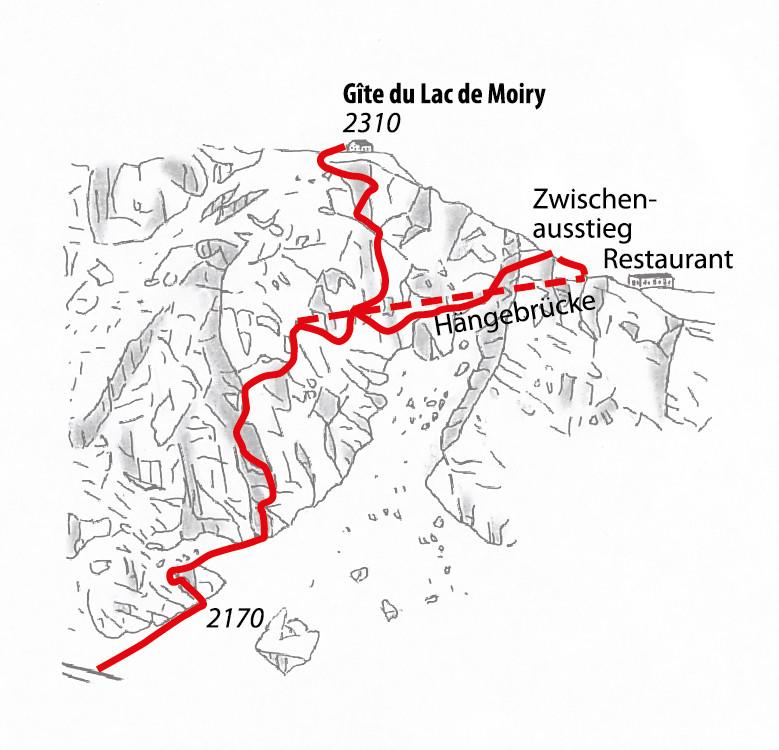
Start up a partly vegetated wall to a niche, then tackle a steep overhanging section and traverse onto an arete. Descend a slightly loose ledge, climb a slab to the route junction, then cross the 60 m suspension bridge. A short cable climb over a rock hump leads to the easier "blue" exit; otherwise turn back into the face beneath the bridge. Descend a rocky K2+ passage and earthy ground, traverse diagonally under overhangs to a second junction, then climb the long, strenuous crux section requiring careful re-clipping. Easier slabs and cracks follow before passing a bunker and railing to reach the Gîte du Lac de Moiry (2310 m).
From the via ferrata's end, follow the road or a steeper shortcut path down to the dam and restaurant. Cross the dam on the road, then before the first tunnel descend a zig-zag path back to the Grimentz Torrent bus stop.
No escape point details are recorded yet.
Typical published season
Year-specific 2026 dates.
VFOS editorial ratings on a 1-5 scale.
Variety
How much the route changes in movement and terrain.
- -
Complexity
Route-finding and technical problem-solving beyond pure grade.
- -
Beauty
Scenery, setting, and overall aesthetic quality.
- -
Exposure
Airiness and exposure independent of technical difficulty.
- -
Sustained effort
How continuous or relentless the physical effort feels.
- -
No crux tags are recorded yet.
Source ratings on the SAC-CAS 1-4 scale.
Plan around the trailhead, parking, and public transport links.
Last lift down
Check operator
Check current local information before setting off.
In Switzerland, call Rega on 1414 for mountain rescue. European emergency number: 112.
Cell coverage can be patchy in gorges, valleys, and behind ridges. Download route notes and tell someone your plan.
This route is flagged as exposed or high-grade; avoid thunderstorms, wet cables, and fast-changing alpine weather.
https://www.valdanniviers.ch/en/P114035/things-to-see-and-do/moiry-via-ferrata
Last scraped: 2 Aug 2026 · Opening-season source retained for status provenance.
https://www.sac-cas.ch/de/huetten-und-touren/sac-tourenportal/gite-du-lac-de-moiry-7801/berg-und-alpinwandern/zustieg-via-ferrata-de-moiry-1000/
Last scraped: 2 Aug 2026 · Official SAC-CAS Route Portal source; English API data and attribution retained.
https://www.sac-cas.ch/de/huetten-und-touren/sac-tourenportal/gite-du-lac-de-moiry-7801/berg-und-alpinwandern/abstieg-via-ferrata-de-moiry-oberer-teil-1001/
Last scraped: 2 Aug 2026 · Official SAC-CAS Route Portal source; English API data and attribution retained.
https://www.sac-cas.ch/de/huetten-und-touren/sac-tourenportal/gite-du-lac-de-moiry-7801/klettersteig/via-ferrata-de-moiry-oberer-teil-734/
Last scraped: 2 Aug 2026 · Official SAC-CAS Route Portal source; English API data and attribution retained.
No contested fields are currently flagged.
Weather