Difficulty
K4
Very difficult via ferrata
Champéry, VS
Image: Daniel Anker
Difficulty
K4
Very difficult via ferrata
Current status
The latest source indicates this route is open
Checked 14 h ago
Total time
2 h 40 min
Approach + via ferrata + descent
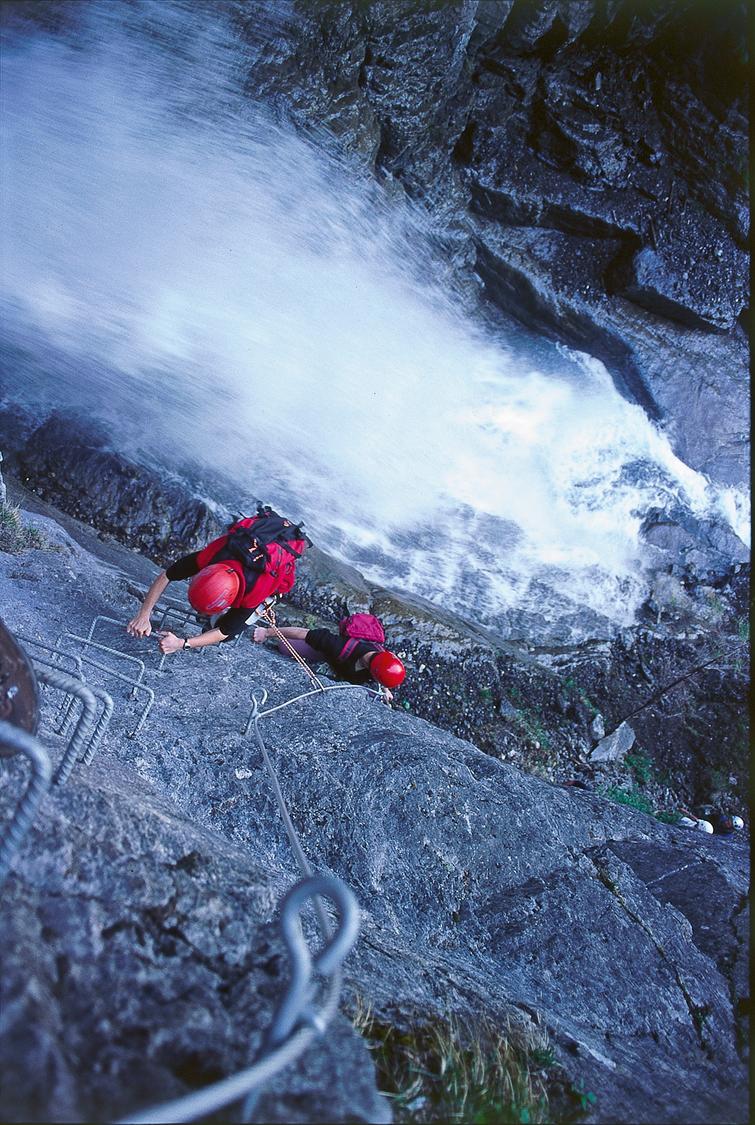
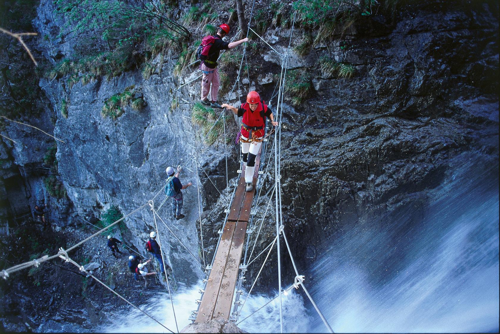
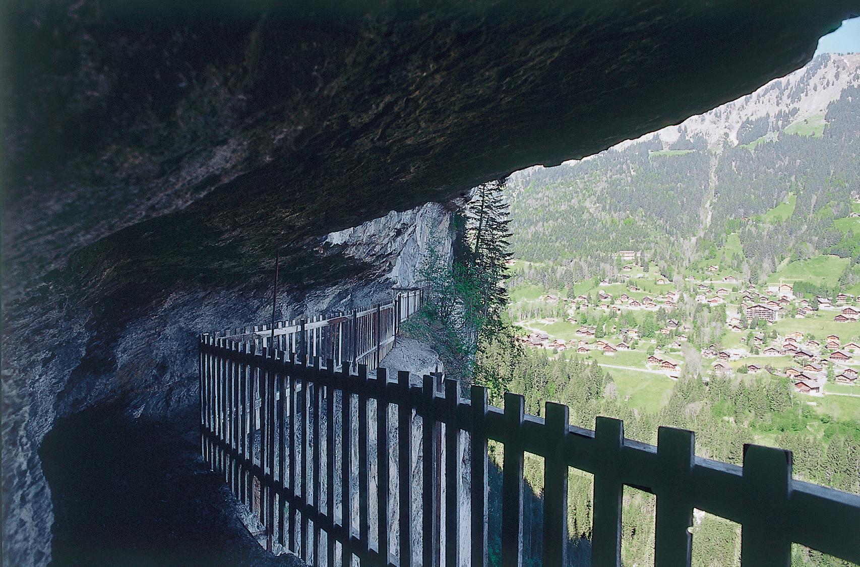
This short but scenic K4 via ferrata climbs a roughly 100-metre wall above the Tière stream at the foot of the Dents du Midi, opposite Champéry. It combines well-secured exposed rock passages, two suspension bridges over the torrent, and a brief overhanging section, followed by a striking descent through the old Défago gallery.
Zoomable topographic map showing available approach, via ferrata, descent, start, finish, and parking geometry. The Download GPX link near the route map heading provides the same route geometry as a file.
Segment timings and vertical stats from the current VFOS dataset.
From Champéry station, walk down-valley on the main road, cross the railway, and descend Chemin de Tavis to Pont de Sous Scex. Cross the bridge, follow the Vièze left then turn right uphill beside the Torrent de Tière through the forest, crossing a footbridge to reach the via ferrata start around 1090 m.
From the base, climb a rock step to a ledge leading into the vertical 'Mur de l'Aragne blantze' wall. Cross the first suspension bridge over the Tière stream, then climb through forest to the longer 'Passerelle des Grandes Casca' bridge. Descend slightly along the Bären-band ledge before traversing the Falaise de Tière, including the overhanging 'Surplomb de la Râtoulive'. Finish with a final vertical climb through the 'Lou Rathé à l'Ano' section to exit the route in the forest at about 1190 m.
From the exit, head down the wild Défago gallery path to a small road at the Tière terrace (1226 m), then follow it southwest to Cantine des Rives (1176 m). Continue down the hiking trail through the Défago gallery cut into the cliff, then at a fork bear right down to the Vièze river (about 960 m). Follow it briefly upstream, cross, and climb back into Champéry village to the train station.
No escape point details are recorded yet.
Typical published season
Live status source; no fixed annual season was published.
VFOS editorial ratings on a 1-5 scale.
Variety
How much the route changes in movement and terrain.
- -
Complexity
Route-finding and technical problem-solving beyond pure grade.
- -
Beauty
Scenery, setting, and overall aesthetic quality.
- -
Exposure
Airiness and exposure independent of technical difficulty.
- -
Sustained effort
How continuous or relentless the physical effort feels.
- -
No crux tags are recorded yet.
Source ratings on the SAC-CAS 1-4 scale.
Plan around the trailhead, parking, and public transport links.
Last lift down
Check operator
Check current local information before setting off.
In Switzerland, call Rega on 1414 for mountain rescue. European emergency number: 112.
Cell coverage can be patchy in gorges, valleys, and behind ridges. Download route notes and tell someone your plan.
This route is flagged as exposed or high-grade; avoid thunderstorms, wet cables, and fast-changing alpine weather.
https://www.regiondentsdumidi.ch/en/541920-via-ferrata-de-tiere-5195/
Last scraped: 2 Aug 2026 · Opening-season source retained for status provenance.
https://www.sac-cas.ch/de/huetten-und-touren/sac-tourenportal/tiere-tiers-7803/berg-und-alpinwandern/zustieg-via-ferrata-de-tiere-1004/
Last scraped: 2 Aug 2026 · Official SAC-CAS Route Portal source; English API data and attribution retained.
https://www.sac-cas.ch/de/huetten-und-touren/sac-tourenportal/tiere-tiers-7803/berg-und-alpinwandern/abstieg-via-ferrata-de-tiere-1005/
Last scraped: 2 Aug 2026 · Official SAC-CAS Route Portal source; English API data and attribution retained.
https://www.sac-cas.ch/de/huetten-und-touren/sac-tourenportal/tiere-tiers-7803/klettersteig/via-ferrata-de-tiere-736/
Last scraped: 2 Aug 2026 · Official SAC-CAS Route Portal source; English API data and attribution retained.
No contested fields are currently flagged.
Weather