Difficulty
K2-K3
Difficult via ferrata
Bornes-Alpen
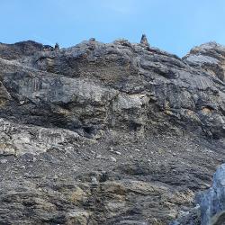
Via ferrata des Dames Anglaises is a K2-K3 via ferrata in Bornes-Alpen.
Image: Source: ferrataguide:376
Difficulty
K2-K3
Difficult via ferrata
Current status
Currently reported open
Checked 17 h ago
Total time
6 h 15 min
Approach + via ferrata + descent
Last lift down
Check Bornes-Alpen timetable
Segment timings and vertical stats from the current VFOS dataset.
Der Einstieg beginnt sogleich mit der Schlüsselstelle, eine steile Querung und ein anschliessender senkrechter Aufschwung. Der weitere Verlauf des Klettersteigs weisst kaum noch ausgesetzte oder sonderlich anspruchsvolle Stellen auf. Einige kleinere Felsaufschwünge könnten auch im Gehgelände umgangen werden. Spannend aber nicht wirklich schwierig ist dann nochmal der Schlussabschnitt, welcher unmittelbar entlang einer felsigen Gratkante verläuft. Nach deren Ende ist der Col de Prapio in ein paar Minuten erreicht.
No escape point details are recorded yet.
Zoomable topographic map showing available approach, via ferrata, descent, start, finish, and parking geometry. The Download GPX link near the route map heading provides the same route geometry as a file.
Plan around the trailhead, parking, and public transport links.
Last lift down
Check operator
VFOS editorial ratings on a 1-5 scale.
Variety
How much the route changes in movement and terrain.
TBC TBC
Complexity
Route-finding and technical problem-solving beyond pure grade.
TBC TBC
Beauty
Scenery, setting, and overall aesthetic quality.
TBC TBC
Exposure
Airiness and exposure independent of technical difficulty.
TBC TBC
Sustained effort
How continuous or relentless the physical effort feels.
TBC TBC
No crux tags are recorded yet.
Via ferrata des Dames Anglaises is a K2-K3 via ferrata in Bornes-Alpen.
Check current local information before setting off.
In Switzerland, call Rega on 1414 for mountain rescue. European emergency number: 112.
Cell coverage can be patchy in gorges, valleys, and behind ridges. Download route notes and tell someone your plan.
Avoid thunderstorms and wet rock. Via ferrata cables can become hazardous quickly in poor weather.
https://ferrataguide.com/ferrata/Via_ferrata_des_Dames_Anglaises
Last scraped: 4 Jun 2026 · Source used for attribution and factual cross-checking; canonical VFOS text is paraphrased separately.
https://www.sac-cas.ch/en/huts-and-tours/sac-route-portal/sex-rouge-vd-1789/via-ferrata/via-ferrata-des-dames-anglaises-the-english-ladies-2518/
Last scraped: 5 Jun 2026 · SAC-CAS route portal source used for route geometry and factual cross-checking; VFOS links back for attribution.
https://www.openstreetmap.org/way/1072467119
Last scraped: 4 Jun 2026 · OpenStreetMap object reference used for coordinate/source provenance; data available under ODbL.
No contested fields are currently flagged.
Weather