Difficulty
K4
Very difficult via ferrata
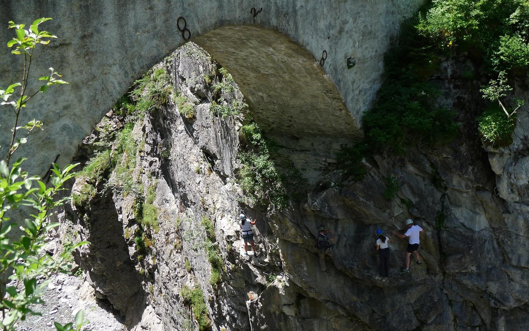
Gorges de Mauvoisin, VS
Image: Valais/Wallis Promotion
Difficulty
K4
Very difficult via ferrata
Current status
The latest source indicates this route is open
Checked 14 h ago
Total time
3 h 45 min
Approach + via ferrata + descent
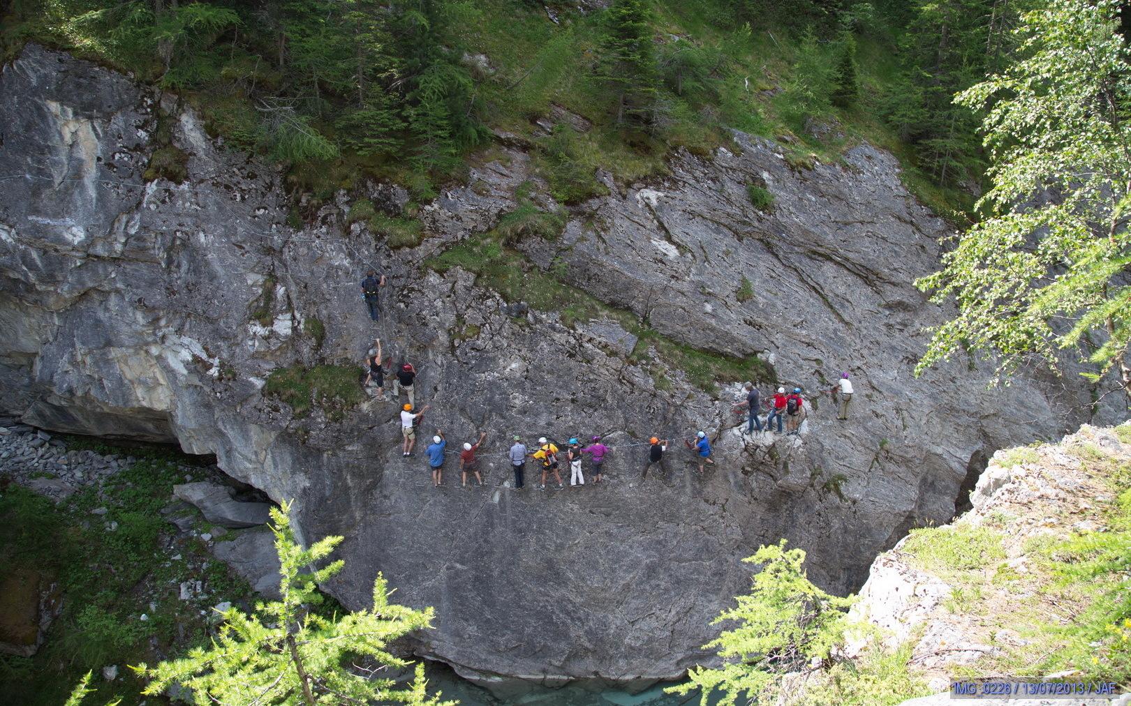
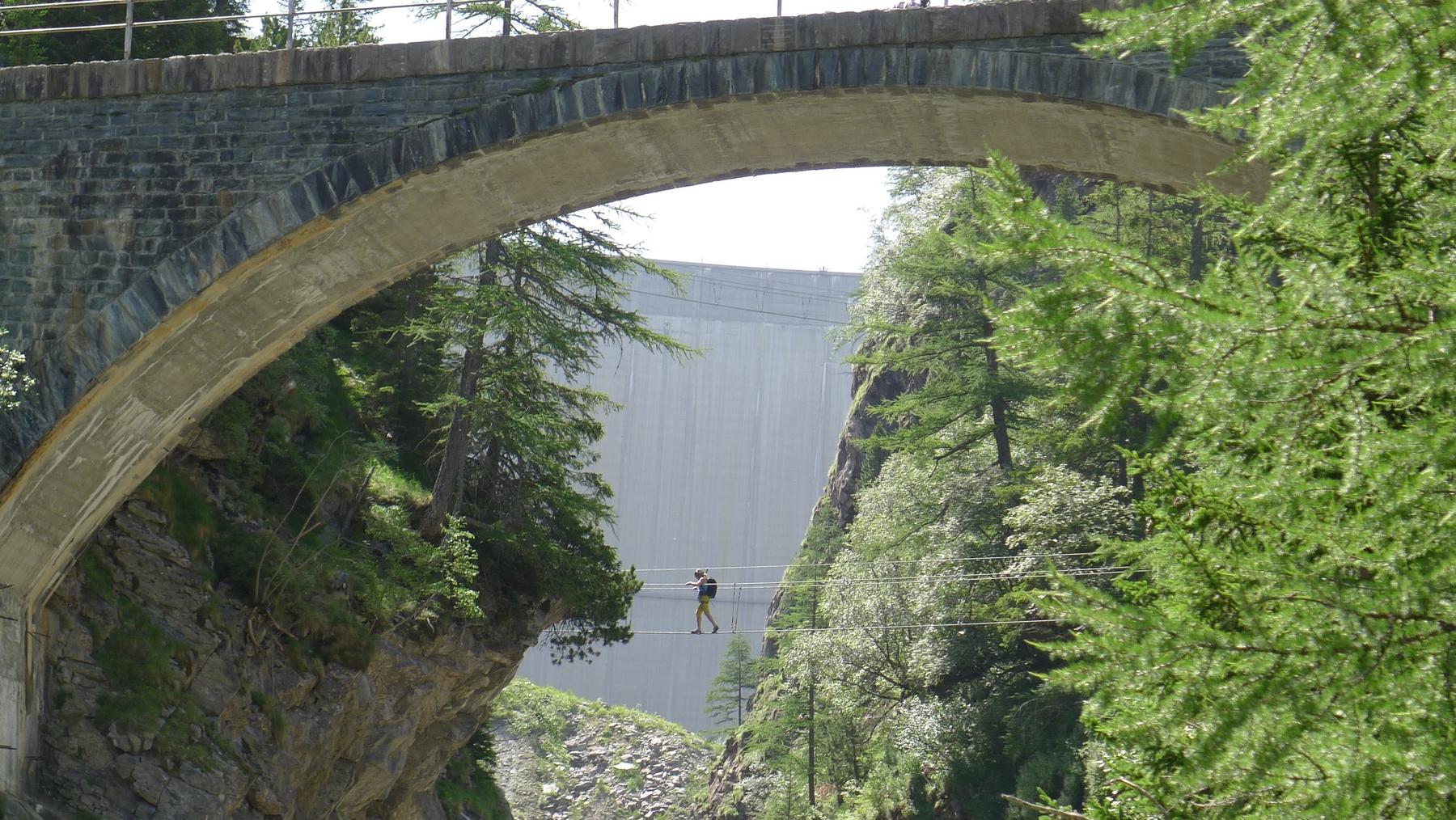
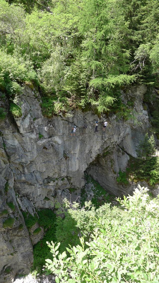
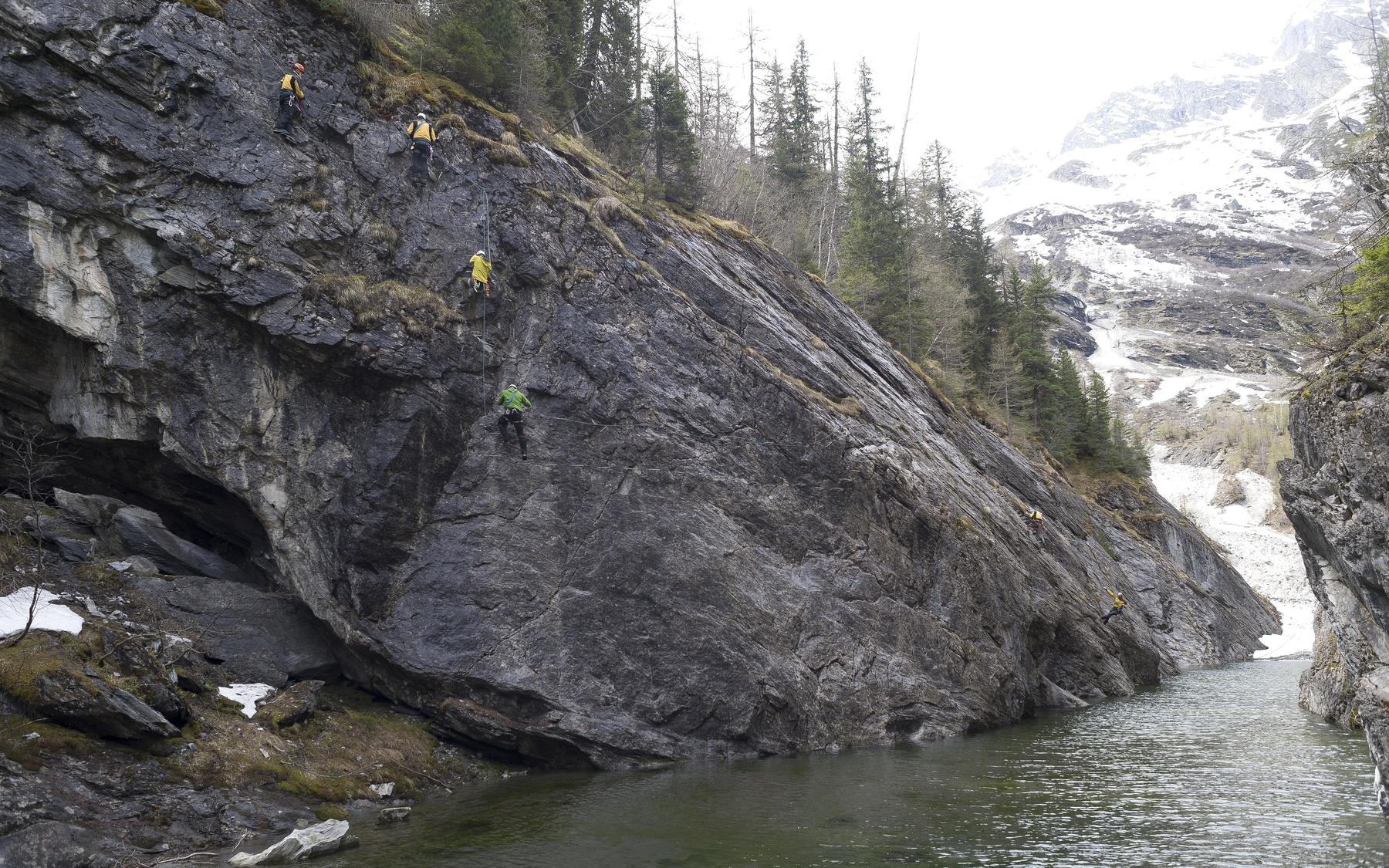
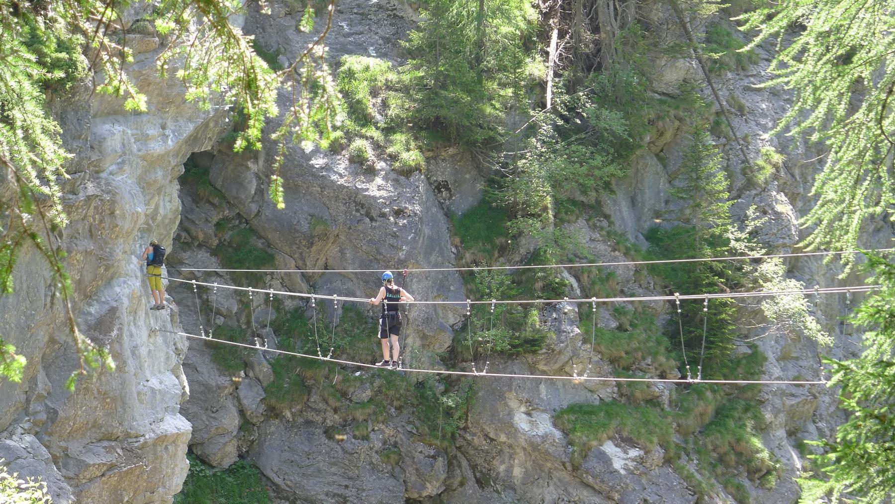
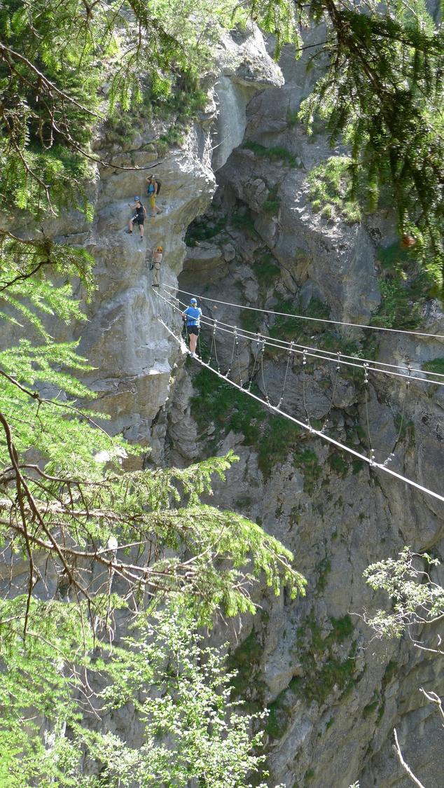
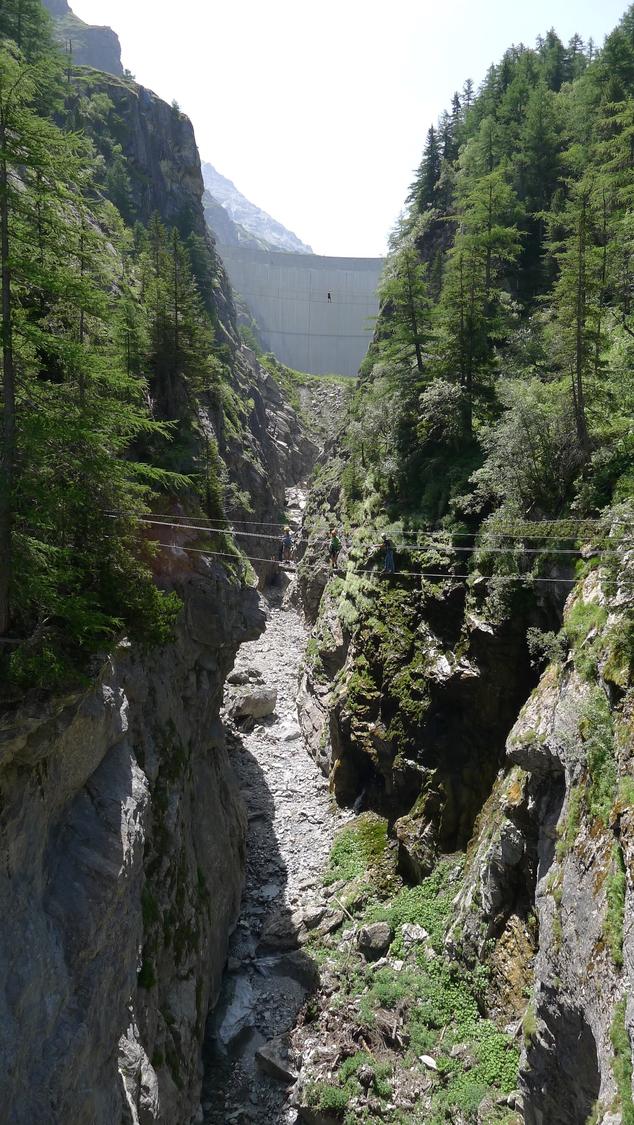
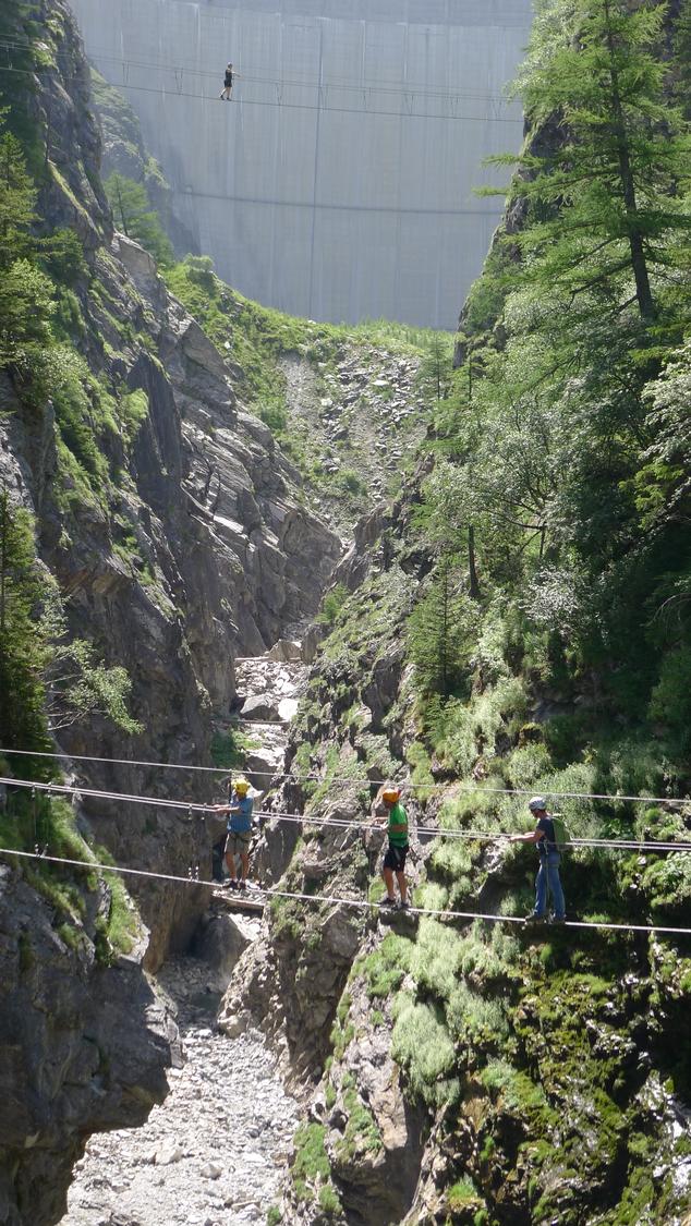
This K4+ via ferrata climbs through the dramatic gorge below the Lac de Mauvoisin dam, one of Switzerland's tallest, in two linked sections known as Saxifrage and Tichodrome. Runoff from the reservoir often thunders through the ravine as the route weaves back and forth across it on seven suspension bridges. Difficulties are short but sustained, making for a varied, athletic outing that finishes right at the Hôtel du Mauvoisin bus stop.
Zoomable topographic map showing available approach, via ferrata, descent, start, finish, and parking geometry. The Download GPX link near the route map heading provides the same route geometry as a file.
Segment timings and vertical stats from the current VFOS dataset.
Reach the route either from the "Pont de Mauvoisin" bus stop or by parking at Hôtel Mauvoisin. From the bus stop, follow brown waymarks down toward the Dranse de Bagnes, pass through a side gorge and climb wooden stairways to reach the start of Saxifrage around 1700 m; a shorter secured alternative path turns left just after the WC.
Saxifrage opens with a 15 m bridge to the far wall, then traverses with repeated ups and downs deeper into the gorge, passing beneath a dam bridge and around an exposed corner into a cove before wooden steps lead back out; a ladder near 1730 m gains an old arch bridge and the connecting trail. Tichodrome begins under the road bridge with a long crossing over the gorge, climbs steeply on the far side, crosses a short three-cable bridge and a longer one back across, then alternates easy and harder sections with short overhangs requiring direct rock climbing. A long traverse reaches a second three-cable bridge, a brushy stretch leads toward an apparent exit near the hotel, but the route continues up a vertical wall via a third three-cable bridge and a final bridge to the last steps, topping out beside the Hôtel du Mauvoisin.
From the top, most parties take the bus from the Hôtel Mauvoisin stop. Those who parked at the start can instead follow the easy hiking trail back down to La Vacheresse / Pont de Mauvoisin.
No escape point details are recorded yet.
Typical published season
The descriptive text also says earliest 1 July for bird protection; the page's current dated schedule is retained and the discrepancy requires monitoring.
VFOS editorial ratings on a 1-5 scale.
Variety
How much the route changes in movement and terrain.
- -
Complexity
Route-finding and technical problem-solving beyond pure grade.
- -
Beauty
Scenery, setting, and overall aesthetic quality.
- -
Exposure
Airiness and exposure independent of technical difficulty.
- -
Sustained effort
How continuous or relentless the physical effort feels.
- -
No crux tags are recorded yet.
Source ratings on the SAC-CAS 1-4 scale.
Plan around the trailhead, parking, and public transport links.
Last lift down
Check operator
Check current local information before setting off.
In Switzerland, call Rega on 1414 for mountain rescue. European emergency number: 112.
Cell coverage can be patchy in gorges, valleys, and behind ridges. Download route notes and tell someone your plan.
This route is flagged as exposed or high-grade; avoid thunderstorms, wet cables, and fast-changing alpine weather.
https://www.verbier.ch/decouvrir/pause-activites-indoor-wellness/via-ferrata-des-gorges-de-mauvoisin-mauvoisin-fr-2788121/
Last scraped: 2 Aug 2026 · Opening-season source retained for status provenance.
https://www.sac-cas.ch/de/huetten-und-touren/sac-tourenportal/gorges-de-mauvoisin-12164/berg-und-alpinwandern/zustieg-via-ferrata-des-gorges-de-mauvoisin-40504/
Last scraped: 2 Aug 2026 · Official SAC-CAS Route Portal source; English API data and attribution retained.
https://www.sac-cas.ch/de/huetten-und-touren/sac-tourenportal/gorges-de-mauvoisin-12164/berg-und-alpinwandern/zustieg-via-ferrata-des-gorges-de-mauvoisin-40504/
Last scraped: 2 Aug 2026 · Official SAC-CAS Route Portal source; English API data and attribution retained.
https://www.sac-cas.ch/de/huetten-und-touren/sac-tourenportal/gorges-de-mauvoisin-12164/klettersteig/via-ferrata-des-gorges-de-mauvoisin-saxifrage-und-tichodrome-759/
Last scraped: 2 Aug 2026 · Official SAC-CAS Route Portal source; English API data and attribution retained.
No contested fields are currently flagged.
Weather