Difficulty
K4
Very difficult via ferrata
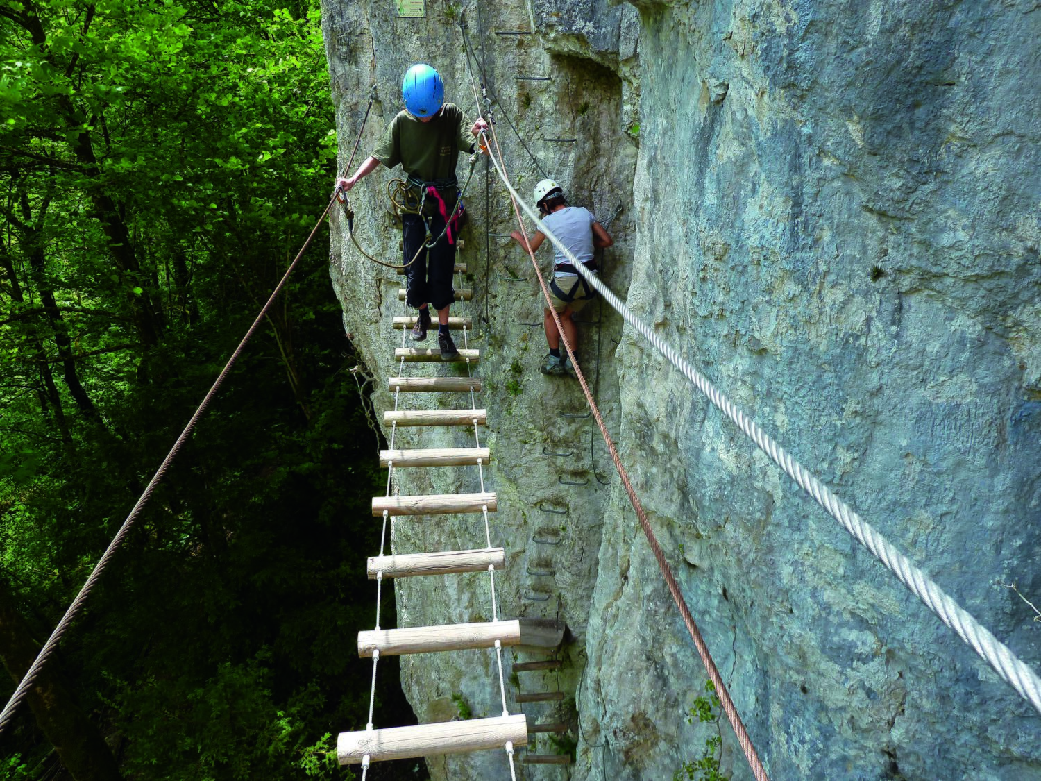
Belvedère Echelles de la Mort, JU
Image: Anker Daniel
Difficulty
K4
Very difficult via ferrata
Current status
The latest source indicates this route is open
Checked 14 h ago
Total time
20 min
Approach + via ferrata + descent
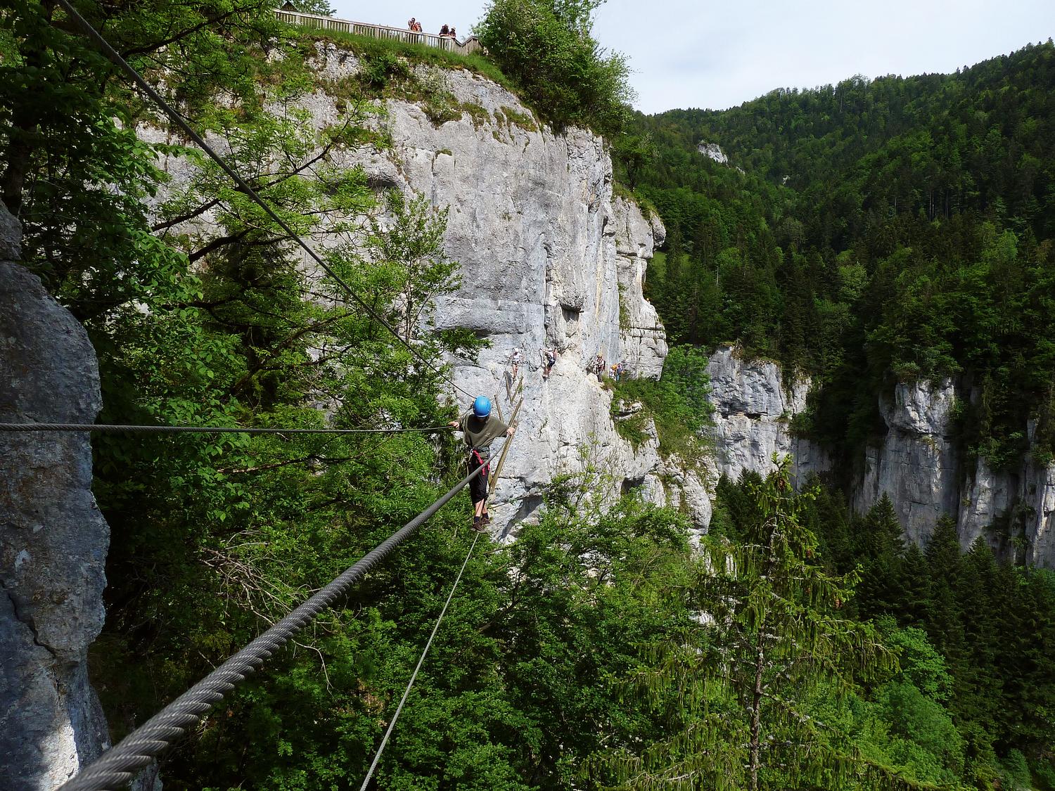
The Echelles de la Mort via ferrata runs through the wild Doubs gorge on the Franco-Swiss border in the Jura, an area once used by smugglers and marked by ruins such as the Moulin de la Mort. Built in 2008, it offers a close-up view of the limestone cliffs and the Aiguille de la Mort, the tallest freestanding rock tower in the Jura. This classic, sporty K4 route follows an almost continuously vertical 500 m rock wall with airy traverses, multiple ladders, and several shaky rope and suspension bridges. An optional Tyrolienne zipline can be used at the end if the correct pulley gear is carried.
Zoomable topographic map showing available approach, via ferrata, descent, start, finish, and parking geometry. The Download GPX link near the route map heading provides the same route geometry as a file.
Segment timings and vertical stats from the current VFOS dataset.
From the Le Refrain car park, a short stroll of about 5 minutes leads to the start of the via ferrata. Those arriving by public transport can walk from Biaufond, Douane along the north bank of the Doubs river to the same car park, taking roughly 1 hour 15 minutes.
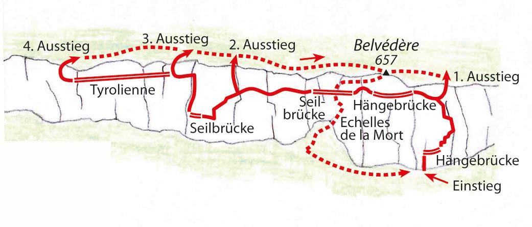
The route starts with a wooden ladder and rock step, followed by a wooden bridge, then continues downstream across a limestone wall using iron rungs and a wooden beam before a steep corner and a narrow vertical ladder. The path then turns to head upriver; an early exit toward the old Echelles de la Mort ladders is possible here for those wanting to bail out. A long, unstable wooden bridge follows, then a descent to an earthy ledge before an even longer suspension bridge crossable by only one person at a time, with the rusted historic Echelles de la Mort ladders visible below. The route continues with exposed up-and-down climbing along the limestone face, compared to the Hinterstoisser Traverse but better protected, followed by another easier rope bridge, a standard ladder, and a telegraph-pole section. At the final junction, climbers can choose the Tyrolienne on the left or the standard exit on the right.
From the normal (third) exit of the via ferrata, turn right to reach the Belvédère viewpoint at 657 m. From there, descend a series of metal ladders and follow the path back down to the Le Refrain car park, a descent of about 15 minutes.
No escape point details are recorded yet.
Typical published season
This cross-border route is on the French side, so no Swiss .ch operating source exists.
VFOS editorial ratings on a 1-5 scale.
Variety
How much the route changes in movement and terrain.
- -
Complexity
Route-finding and technical problem-solving beyond pure grade.
- -
Beauty
Scenery, setting, and overall aesthetic quality.
- -
Exposure
Airiness and exposure independent of technical difficulty.
- -
Sustained effort
How continuous or relentless the physical effort feels.
- -
No crux tags are recorded yet.
Source ratings on the SAC-CAS 1-4 scale.
Plan around the trailhead, parking, and public transport links.
Last lift down
Check operator
Check current local information before setting off.
In Switzerland, call Rega on 1414 for mountain rescue. European emergency number: 112.
Cell coverage can be patchy in gorges, valleys, and behind ridges. Download route notes and tell someone your plan.
This route is flagged as exposed or high-grade; avoid thunderstorms, wet cables, and fast-changing alpine weather.
https://www.pays-horloger.com/echelles-de-la-mort/
Last scraped: 2 Aug 2026 · Opening-season source retained for status provenance.
https://www.sac-cas.ch/de/huetten-und-touren/sac-tourenportal/belvedere-echelles-de-la-mort-7813/berg-und-alpinwandern/zu-und-abstieg-klettersteig-echelles-de-la-mort-1980/
Last scraped: 2 Aug 2026 · Official SAC-CAS Route Portal source; English API data and attribution retained.
https://www.sac-cas.ch/de/huetten-und-touren/sac-tourenportal/belvedere-echelles-de-la-mort-7813/berg-und-alpinwandern/zu-und-abstieg-klettersteig-echelles-de-la-mort-1980/
Last scraped: 2 Aug 2026 · Official SAC-CAS Route Portal source; English API data and attribution retained.
https://www.sac-cas.ch/de/huetten-und-touren/sac-tourenportal/belvedere-echelles-de-la-mort-7813/klettersteig/via-ferrata-echelles-de-la-mort-753/
Last scraped: 2 Aug 2026 · Official SAC-CAS Route Portal source; English API data and attribution retained.
No contested fields are currently flagged.
Weather